Wishing all of you a happy holiday season. May you be warm and safe, wherever you are.

We’d also like to say a big thank you, for following our big, crazy adventure!
“Shells Sink, Dreams Float. Life’s Good On Our Boat!”
Wishing all of you a happy holiday season. May you be warm and safe, wherever you are.
We’d also like to say a big thank you, for following our big, crazy adventure!
“Shells Sink, Dreams Float. Life’s Good On Our Boat!”
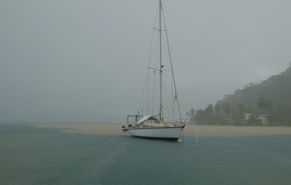
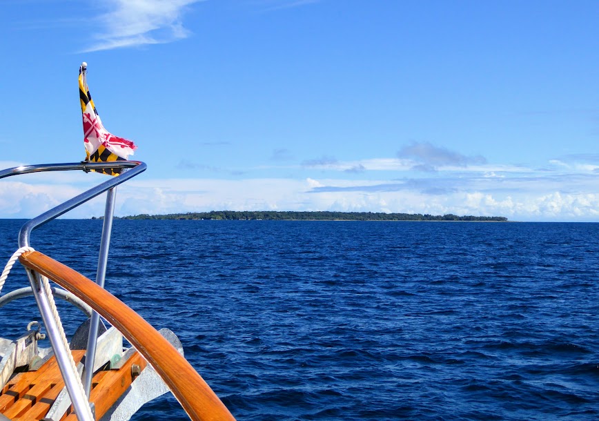
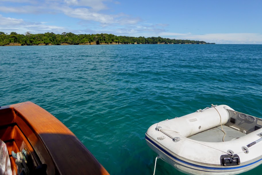
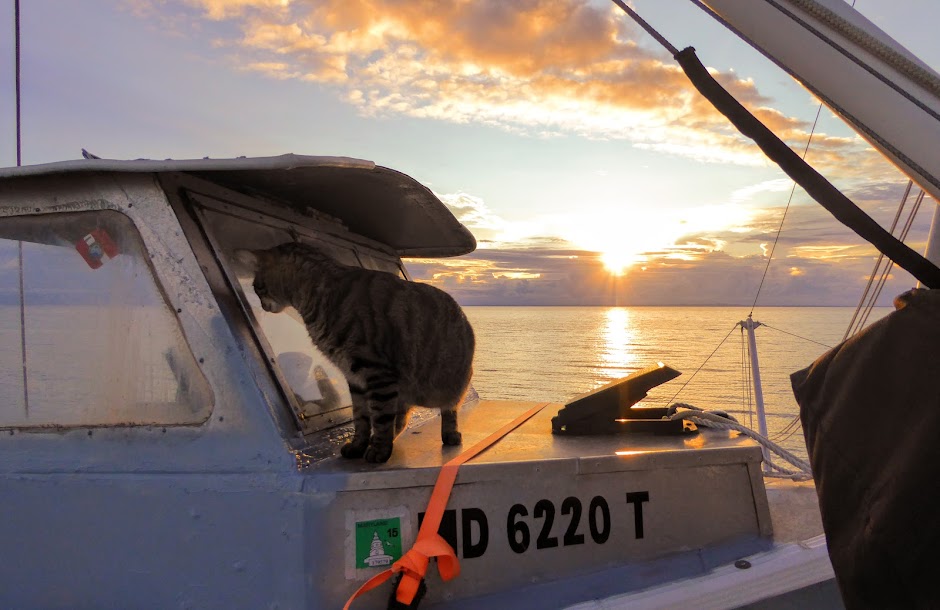
We’ve picked up a decent cell signal, coming into the outskirts of the San Blas Islands, so I’m sending out a quick hello.
Trip has gone well, big swells, but spread far apart enough that we’re not getting tossed around badly. Scott fought queasiness until we tucked behind the first islands. Howard has traveled like a champ, choosing to just sleep through it and I’ve watched several movies.
The first islands we’re coming up on are popular for charters and such, and as you may expect, there are many boats here. Our plan is to keep going, and anchor farther out, in what’s called the Hollandaise area, where we’ll be at anchor until after the new year.
Just a few quick photos!
“Shells Sink, Dreams Float. Life’s Good On Our Boat!”
This morning, we’ll make our way toward the San Blas Islands, where we plan to stay until early April. As usual, we expected to be settled there already, but Mother Nature again intervened.
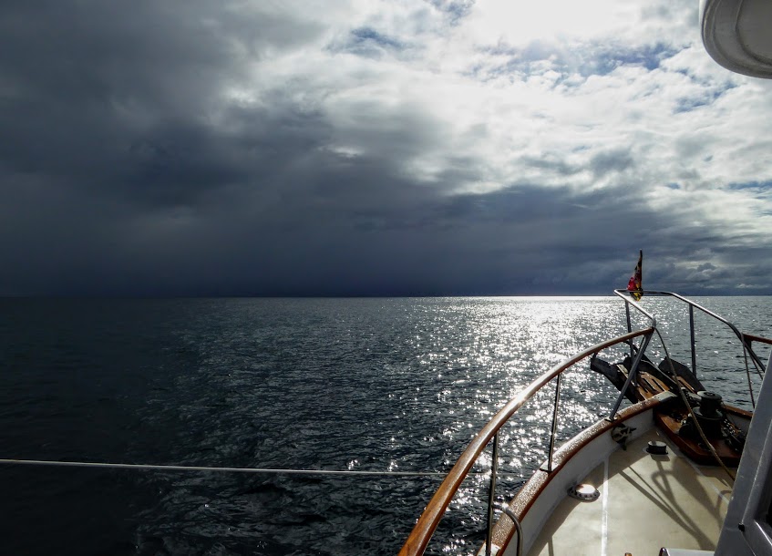
After Otto passed by, the Christmas winds that regularly build in the Eastern Caribbean began to blow. While we don’t get the wind speed down here, it does drive large swells our way. As a result, our 8-10 hour ride should be interesting.
We expect swells of eight feet or so, which won’t be so bad if they are timed well and winds stay light and variable, as forecasted; the big word here is IF. Either way, the seas won’t get any better this time of year, so it’s off we go.
As I mentioned previously, the San Blas Islands are a remote area is located on the northwest coast of Panama, in the Caribbean Sea.

There are conflicting numbers, but between 365 and 400 islands make up the archipelago, only 49 or so of which are inhabited (not the best detailed map, but the best I could find online).

The 100 square mile area is home to an indigenous group known as the Gunas, and the islands are also referred to as the Guna Yala region. Internet will be sparse for us this winter, so I thought I’d share what I’ve learned so far, about the Guna people..
The approximate 50,000 Gunas in the San Blas have their own language, but also speak Spanish, and more recently, English.
They have a matriarchal society, in which inheritance passes down to the women. A young man, after marriage, must move in with his in-laws, and work for several years under the apprenticeship of his father-in-law. Daughters of the Guna are prized, because they will eventually bring additional manpower to the family.
Divorce is rare, although all that is required is for the husband, should it happen, is to gather his clothes and move out of the house (too bad it doesn’t usually work out this nicely elsewhere).
There is a division of labor within families. The husband gathers coconuts, cultivates food, provides firewood, repairs the house, makes his and his son’s clothes, weaves baskets and carves wooden utensils. The wife prepares the food, collects fresh water from the mainland rivers, unloads the boats, sews female garments, washes clothes and cleans the house.
Before the arrival of Europeans, the Guna wore few clothes, and decorated their bodies with colorful designs. When encouraged to wear clothes by the missionaries, they copied these designs in molas, which were then worn as clothing.
The Gunas are now famous for their molas, which are handmade using a reverse applique technique. Several layers (usually two to seven) of different color cloth (usually cotton) are sewn together; the design is then formed by cutting away parts of each layer.
The edges of the layers are then turned under and sewn down. Often, the stitches are nearly invisible. The finest molas have extremely fine stitching, made using tiny needles. (I borrowed this description from Wikipedia, where there is much more interesting mola information).

Mola means “clothing” in the Guna language, and the panels are used to make blouses, worn daily by most Guna women (men wear western dress). We’re told that looks like this are the norm on the islands of the Guna Yala region, and it seems the women also enjoy pipe smoking.


The economy of the Guna Yala is based on agriculture and fishing. Plantains, coconuts and fish is their core diet, supplemented by simple imported foods, a few domestic animals and wild game. Coconuts and lobsters are widely exported products, and migrant labor and the sale of molas provide other sources of income.


In 1925, there was a revolution between the Guna Indians and the ruling Panamanian authorities, who attempted to force the Guna to adopt Hispanic culture by military action. During this revolution, the Guna Yala territory seceded, and operated as the short-lived Republic of Tule.
Following mediation with the United States, the Guna re-united with Panama. With the support of the Panamanian government, the Gunas created a self-governing territory, named the Guna Yala district, where they would rule themselves.
Relations are still strained between mainland Panama and the Guna Yala region. Most recently, both customs and immigration have moved out of the area, and cruisers now have to clear in and out of the country on the mainland. Going to one town for customs, and another for immigration; frustrating!
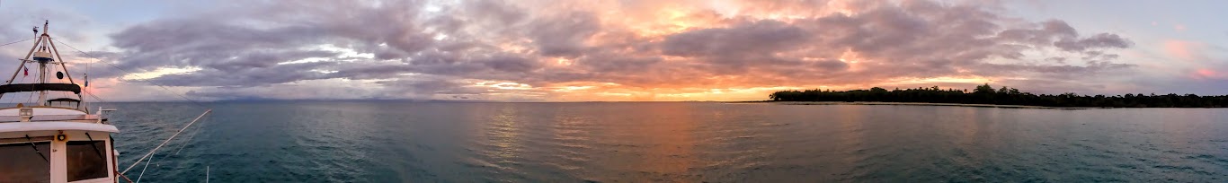
We’re looking forward to visiting this area for the winter months, and will look for a window of weather in late March, to travel to Cartagena, Colombia, before continuing on to the Eastern Caribbean.
As usual, you can track us on the Where Are We Now page, where you can also send an email through our Delorme satellite tracker. We look forward to a winter of views like this!

“Shells Sink, Dreams Float. Life’s Good On Our Boat!”
They say that Panama has two seasons, the dry season from December to mid March, and the wet, or “green”, season from mid March to mid December. As you might deduce from their names, the dry season means little or no rainfall, while the green season can mean rain almost every day.
However, in Bocas del Toro, it rains consistently nearly every month, except for September and October. Fortunately, the wet stuff usually comes overnight or in the early am, giving way to the brutal, hot sun. November is a different animal altogether; a rainy season unto itself.
At last check, when we left Red Frog after Thanksgiving, the monthly rain total was over seventeen inches for the month! The rain during November was often biblical. Heavy, driving rain would pour straight down for hours, and the sound was unnerving. Roads flooded almost instantly, and any grass-like surface turned to muck.
Visibility disappears in an instant, and the water turns to mud. For example, now you see it:
Now you don’t:
This nasty brown line floated our way during a recent deluge:
Scott installed a new weather station in November, after our old one gave up the goat. The new one has many more bells and whistles, and greatly appeals to Scott’s inner weather geek. For example, note how it describes a November deluge, using the most weather specific terms (bottom right corner):
To be fair, it definitely was raining cats and dogs, so kudos weather station!
This crazy rain has extended into December, and in the first ten days of the month, we’d already received close to twelve inches! Recently, just in the morning hours alone we had 3.18 inches, and at one point, the rain rate listed on the weather station was 6.86 inches an hour….biblical I tell ya!
It’s definitely the wettest area we’ve ever been to, including any travel by land, car, air or boat before this cruising adventure. As you can imagine, the humidity matches the wetness, turning our decks and lines green, and making daily tasks a challenge. Thank goodness we spent the time plugged in, and able to keep the interior humidity in check with air conditioning.
On the bright side, everything here is beautifully lush and green. Trees and foliage grow thick and tall, and brightly colored plants and flowers spring up from the ground.
We were surprised not to see more fresh, local produce grown in the area, but suspect that too much of a good thing may hinder good veggie growth.
All in all, we’ve become accustomed to traveling with an umbrella at the ready (it’s far too warm and humid for rain jackets, as they become your own personal sauna, despite the best ventilation), and push on, despite the wetness. It beats a 45 degree rain that the northeast can get this time of year, so we try to embrace Panama’s “liquid sunshine”!
“Shells Sink, Dreams Float. Life’s Good On Our Boat!”
The rain here in Panama is insane. When we arrived, uring the “rainy” season, but November in particular really gave us a dousing. Heavy rain lasts for hours at a time, flooding streets, and turning grassy areas into muck.
After our overnight in Panama City, we planned a train ride back to the Caribbean coast. Instead of taking a cab all the way to Linton Bay, we decided to hop on the Panama Canal Railway to Colon, and take a cab back to Sea Life from there.
The Panama Canal Railway runs parallel to the Panama Canal, linking the Atlantic and Pacific Oceans. The route stretches 47.6 miles across the Isthmus of Panama, from Colon on the Atlantic side, to Balboa in Panama City. It was the most expensive railroad ever built, at a cost of eight million dollars, and at $295.00 a share, the Panama Railroad was at one time the highest stock listed on the New York Stock Exchange.

The primary reason for building the railroad was to increase traffic to California, due to the Gold Rush in 1849. Construction began in 1850, and the first money-making train ran over the full length of track in January of 1855. The Panama Railroad was referred to as an inter-oceanic railroad, and later a “transcontinental” railroad, despite the fact that it only spanned Panama’s narrow width.
As with the construction of the Panama canal, the area was not an ideal location to build a railroad. From June through December there were deluges of rain (which we can attest to) that often lasted as long as three days. The whole area was covered with dense jungle, thick with humidity, and there was no durable timber for construction. In addition, the native people were not used to physical labor, and were undependable. Men, materials and provisions all had to be imported from thousands of miles away.
Cholera, yellow fever and malaria took a severe, deadly toll on construction. Despite the fact that large numbers of new workers were constantly being brought in from the United States, the Caribbean Islands, and as far away as Ireland, India, China and Australia, there were times when work was stalled for simple lack of “live” or healthy workers. Disposing of the dead became such a problem, that the railroad started “pickling” the bodies in barrels, and selling them to medical schools! The proceeds were used to build a hospital for the railroad (a hell of a fundraiser!).
In 1881, the French purchased controlling shares in the Panama Railroad Company, and employed the railroad in the excavation of the Panama Canal. In 1904, the United States purchased the railroad from the French, when they took over canal construction. The railroad closely paralleled the canal, and was moved and reconstructed where it interfered with canal work. New sections were built on higher ground, using heavier gauge line.
The use of the railroad was vital in construction of the Panama Canal. Two hundred train loads of dirt were removed every day from work sites, and the railroad also transported materials and labor. In addition, the trains served as sleeping quarters for workers.


Once complete, the railroad became one of the most profitable in the world, charging up to $25.00 per passenger to travel over the 47 miles of track. It was an engineering marvel of the era, until the opening of the Panama Canal, and carried the heaviest volume of freight per unit length of any railroad in the world. The existence of the railway was key in the selection of the canal site.
After World War II, few improvements were made to the railway, and it declined after the U.S. government handed over control to the government of Panama in 1979. In 1988, the government of Panama turned over control to the private, Panama Canal Railway Company, who launched a large renovation project. In 2001, the railway reopened, and began “coast to coast” passenger train service; container service soon followed.
Ok, back to our ride…
The main purpose of the train is as a commuter rail for people living in Panama City, working in Colon, but it has also become popular for tourists as well. Several of our cruiser friends had taken the ride, and highly recommended it. Passenger service only runs twice a day, with a train leaving Panama City in the morning, and returning from Colon in the late afternoon. Since we only had one choice for departure, we arrived at the station early in the morning, purchased tickets and climbed aboard for the hour-long, cross country ride.

Inside, the cars had the feel of the early 1900’s, with dark wood paneling and carpeted floors. Both booth and table seating lined either side of the aisle, offering clear views out of large windows.

We were given a breakfast snack box, which was barely touched before Scott had ants in his pants to head out to the observation deck between cars.
Since the railway parallels the canal route, we were able to see boats transiting the canal’s waterways. Some we’d seen from out hotel balcony the night before…pretty neat!
We also passed by areas where old buoys, work boats and other canal maintenance equipment was kept, including dredging pipe and the huge machines used to keep the canal route clear.
The railway runs through the jungle, and across Lake Gatun. We spent the entire hour outside, taking in the scenery passing by.

All to soon, we made our way closer to Colon, and approached the train yard where our ride would end.
We hopped off, and went to hail a cab. Our ride back to Linton Bay took us right past some large grocery stores, so we stoped for some final provisioning before heading to the San Blas Islands. Our driver waited for us to shop, which was great (I think he killed two birds with one stone, as I saw him getting lunch at the deli inside), as hailing a cab in the congested area may have been challenging. As we loaded in our groceries, I enjoyed the smell of Christmas trees for sale outside the store.
The drive from the grocery store to the marina was like an amusement park ride. It was clear that the driver wasn’t familiar with the roads, but that didn’t stop him from driving like crazy to get there, as he tested the limits of the cab’s brakes and steering. I was sure poor Scott was going to have permanent dents in his leg, from where I continually grabbed it in fear.
Thankfully, we arrived back at Linton Bay Marina in one piece. We unloaded our things, and told Howard all about our adventure. He was only interested in a full bowl of food, but we thought that train travel was pretty cool. Here are many, many more photos.
“Shells Sink, Dreams Float. Life’s Good On Our Boat!”
Jumping back several months, to catch you up on our canal adventure:
Our cruising plans do not include transiting the Panama Canal. It’s a substantial cost, and I have no interest in crossing the Pacific (after our passage to Puerto Rico, neither does Scott). However, being one of the seven modern wonders of the world, and Panama’s biggest tourist attraction, we were very interested to see the canal. Since our route from Bocas del Toro to the San Blas islands took us within a few hours of the canal’s visitor center, it seemed a shame not to visit.
But first, here’s some interesting history of the Panama Canal, and it’s construction (with some cool visual aides):
The idea of creating a water passage across the isthmus of Panama to connect the Atlantic and Pacific Oceans dates back to the 1500s, when Spain surveyed a possible route across Panama’s Chagres River. The idea seemed impossible at the time, but remained intriguing a potential shortcut from Europe to Eastern Asia.

France was first to attempt the daunting task. They planned a sea-level canal, with Count Ferdinand de Lessep (builder of the Suez Canal in Egypt) in charge of the project. After breaking ground in 1880, the construction team soon realized the monumental challenge ahead of them.
They were plagued by yellow fever and malaria, and incessant rains caused heavy landslides. De Leeps realized that a sea-level canal was too difficult, and shifted his plan to a lock canal. However, it was too late; funding was pulled from the project in 1888, after nine years and a loss of approximately 20,000 lives.


With a push from President Theodore Roosevelt, the U.S. purchased the French assets in the canal zone for $40 million in 1902. After a proposed treaty over rights to build in Panama was rejected (at the time, it was a Colombian controlled territory), the U.S. threw its military weight behind Panama’s fight for independence from Colombia.
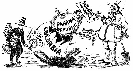
In November of 1903, the U.S. negotiated a deal with the newly declared Republic of Panama, that gave them rights to the canal zone. In exchange for the ten mile stretch of land, the U.S made a one-time, $10 million dollar payment, annual payments of $250,000 and agreed to guarantee the independence of Panama.
The U.S. also had plans for a sea-level canal, but much of the French equipment was in need of repair, and the threat of malaria and yellow fever was frightening off the workforce.
A railroad specialist took over on July of 1905, and immediately recruited West Indian laborers to solve the workforce issues. He ordered new equipment, and came up with more efficient ways to speed up the work. In addition, he realized the difficulties that landslides posed, and convinced President Roosevelt that a lock canal would be best for the area’s terrain.


What helped the project immensely was the chief sanitary officer’s belief that mosquitoes carried the deadly diseases plaguing the area (who knew they had a chief sanitary officer??). On a mission to wipe out the pesky mosquitoes, his team diligently fumigated homes, and cleansed pools of water. The last reported case of yellow fever in Panama was in 1905, and malaria cases dropped sharply over the following decade.

In 1906, a new chief engineer took over, and he focused efforts on the Culebra Cut, a nine mile stretch of mountain range along the canal route. Clearing this area became a 24-7 operation, with more than 6,000 men contributing at any one time. Despite the attention paid to this section of the project, the Culebra Cut was a notorious danger zone. There were many, many casualties from unpredictable landslides and dynamite explosions (Good grief, its a wonder this thing ever got built!).


Construction of the locks began in August 1909. Built in pairs, each lock chamber leveraged gravity to raise and lower water levels (there were/are no pumps used). Ultimately, the three locks along the canal route lifted ships 85 feet above sea level, to the man-made Gatun lock in the middle. The entire operation was powered by electricity, and run through a control board.


The gates separating the chambers in each set of locks hold back a considerable weight of water, and had to be made both reliable and strong enough to withstand accidents, as their failure could unleash a catastrophic flood of water downstream (bad for business) .
Ranging in size from 47 to 82 ft high, depending on position,the gates are enormous, and are 7 ft thick; the hinges alone each weigh almost 17 tons! They can be opened during the operating cycle only when the water level on both sides is equal.

The original gates are still in use, but their mechanisms were replaced with hydraulic struts in January 1998, after 84 years of service. Much like the hull of a ship, the lock gates are hollow and buoyant. They are so well balanced that two 25 hp motors are enough to move each leaf. If one motor fails, the other can still operate the gate at reduced speed.


In October of 1913, President Roosevelt operated a telegraph at the White House that triggered an explosion of Gamboa dike, flooding the final stretch of dry passageway at Culebra Cut.

The Panama Canal officially opened on August 15, 1914, but a grand ceremony was downgraded, due to the start of WWI. The canal was completed at a cost of more than $350 million, and was the most expensive construction project in U.S. history at the time.


The canal was a vital part of expanding global trade routes in the 20th century. Transition of overseeing the canal, from the U.S. to Panama, began in 1977, with a treaty signed by President Carter, and the Panama Canal Authority assumed full control on December 31, 1999. In September 2010, the canal hosted its 1 millionth passing ship, and in 2016 a massive canal expansion opened, doubling the waterway’s capacity.


Here endeth the lesson.
After our short stay in Portobelo, we headed to nearby Linton Bay, which is just over an hour car ride to the visitor’s center at the canal’s Mira Flores Locks. It was also a short ride to a grocery store for provisioning, and an easy jump off point to head for the San Blas. We decided to leave the boat at Linton Bay Marina. From there we could visit the canal, spend the night in Panama City and return the next morning, with Howard and Sea Life tucked into a slip for safe keeping.
We arranged for a cab to take us from the marina to the Miraflores Locks, traveling winding, hilly roads along the way, and arrived at the visitor’s center an hour or so later. The ticket office was not yet open, but there were already many people waiting to get in. We took our place in line, just beating a huge tour bus full of people..whew!
After purchasing our tickets and heading inside, we were told to make our way up to viewing area on the fourth floor, as there were ships entering the locks. Once off the elevator, we managed to get a front row spot on the rail, and settled in to watch the large ships “lock through.”
As ships approach from the Pacific side, two locks at the Mira Flores Locks raise them up into Mira Flores Lake. At the other end of the lake, a single lock at Pedro Miguel Lock raises them again, into Gatun Lake and then a triple set of locks at Gatun Locks lower the ships back down to sea level in the Caribbean sea.


Though the channels in the locks seem large enough for ships to pass in both directions at the same time, the Culebra Cut makes this impossible. The area is far too narrow for the large ships to pass each other, so two “lanes” transit traffic from the Caribbean to the Pacific in the morning, and then the direction shifts, for those transiting from the Pacific to the Caribbean.
We were watching ships pass from north to south. They had transited from the Caribbean, and entered the locks from the Mira Flores lake. There were no private/pleasure boats coming through when we visited, only large ships and smaller commercial vessels.
Pleasure boats and small fishing boats usually transit very early in the morning, or after dark. They are tied together, or to a canal tug, as they move through. We have several friends who’ve transited the canal, and all have stories of things not going exactly as planned. Here are some photos. They also have great blogs!


s/v Morpheous of London (Richard & Jan)


Mini towing locomotives, called mules, are used for side-to-side and braking control in the locks (Forward motion into and through the locks is actually provided by the ship’s engines). The mules run on “rack tracks,” to which they are geared, and their traction is electric, supplied through a third rail that is laid below surface level on the land side of the channels.
Large ships have two mules on each side at the bow, and two each side at the stern—eight in total, allowing for precise control of the ship. Each mule has a powerful winch, operated by the driver; these are used to take two cables in and out as needed, in order to keep the ship centered in the lock while moving it from chamber to chamber. With the larger ships having very little clearance, the mule operators have to be pretty good at what they do!
All ship captains are required to yield control to a canal pilot while transiting, who are specially trained to guide vessels of all sizes safely through the locks. Some ships are so wide that they clear the concrete walls by mere inches. A lock master is in position on either side of the lock, and is in constant communication with the pilots and the control tower during the entire process.
An announcer narrates details about each ship passing through the two lanes, providing the country of origin, what type of cargo is on board and other details. Relayed in both Spanish and English, the information was both interesting and helpful as we watched the huge ships pass by us.
We saw some amusing sights as the ships passed by: a basketball court on the deck of a ship, crew members enjoying the ride in a shady spot and the amount of radar waves that we were exposed to at the observation deck level!
When the canal opened, a set of guidelines were put in place for the maximum requirements of ships transiting across. “Panamax” includes the width and length of the available lock chambers, the depth of water in the canal and the height of the bridges that span the it. A new set of locks opened in June of 2016, allowing larger, “New Panamax” ships to transit back and forth. From our spot on the viewing deck, we could see ships transiting those lanes as well.
There was so much see; we stayed on the viewing deck for hours, taking it all in. When all the ships has locked through, we headed downstairs to check out the rest of the visitors center. There was a short film on the history of the canal, and many rooms of exhibits, containing information about the canal’s construction. We ended our visit with a spin through the gift shop, and then went outside to catch a cab to our hotel, stopping on the way at McDonald’s, for Scott to get a fast food fix!
At the recommendation of one of our friends at Red Frog marina, in Bocas del Toro, I’d booked a room at the Comfort Inn and Suites, which sits right on the canal route. The balcony rooms look over the Balboa Yacht Club’s many boats at anchor, and ships on their way to and from the locks.
Scott kept watch online, in live time, to see when a ship was coming our way. We’d take a break from the air conditioning, and watching English television channels, to go out and watch them pass by (our balcony was in full sun until dusk, so small bursts of outside time were all we could handle).
Our water view all but disappeared during a late afternoon downpour, as the streets below quickly flooded.
Now you see it…
Now you don’t…
We ate a room service steak dinners on our king-size bed, enjoyed long, “roomy” showers, and kept a “ship watch” out the window until well after dark, and again at first light the next morning.
It was a great Christmas treat to ourselves! Here are many more photos.
“Shells Sink, Dreams Float. Life’s Good On Our Boat!”
Because it was one of the most important ports on the route of their treasure fleet, the Spanish built several defensive forts in Portobelo. At one time, ten different fortifications were built on the hills behind the city’s port, making it the most heavily fortified Spanish coastal control point in the Americas.
Pirates destroyed them several times, but several of the fortresses still survive, and in 1980, their ruins were designated as a UNESCO World Heritage Site (criteria for World Heritage Sites).
We first visited Fort Santiago, which sits on the south side of the harbor.
Houses now sit among part of the fort’s waterfront walls, and it’s upper battery, across the main road, is completely over grown.
Men who built these forts were definitely shorter (and most Panamanians still are). Scott seemed giant, in front of a doorway.
Our next stop was the custom house, located just off of the square in town.
Built in 1630, it was the headquarters for all of the Spanish custom offices. Gold and silver from the Inca Empire was exported through this custom house, and countless African slaves were imported to the New World from here as well. This huge building was the scene of many large trade fairs, until it was bombed by English pirates.
There was a small museum inside, with photos of the custom house in it’s heyday, in disrepair and before and after it’s reconstruction in the 1990’s. A display of period weaponry caught Scott’s eye. He especially liked this gun/hatchet thing.
The next fort, San Jeronimo, is located just outside the custom house.
This fort is affected by high tide, and we had to slop through water and mud to get to the walls, and look out to the harbor.
Several wrecked boats were visible from San Jeronimo’s walls. The most recent, from Hurriane Otto’s swells, still had people aboard, living life at a 45 degree angle.
While wandering the grounds, we were entertained by a happy group of school children, who gathered just inside the fort to sing and dance for donations.
Lastly, Fort San Fernandino sits on the north side of the harbor, just near where we were anchored.
We beached our dinghy, and trekked through tall grass to the first battery level. There was a wobbly, narrow wooden board across the dry moat. I ran to the other side, Scott took his time.
We traipsed around the lower battery level, wandering through stone doorways, around crumbling corners, and peeking through walls, back down at Sea Life below in the harbor.
Next, we climbed a steep hill to the upper battery. The tall grass was full of burrs, that covered my shoes and pants. There were some set-in steps for part of the climb, but the remainder was just a foot path.
The views looking back at town and down to the harbor were even better at this level.
Scott noticed this small house-like structure, and had a peek inside. House-like was right, as in outhouse…the seat looked less than comfy!
Further up the hill, there is another, smaller fort that was built to store gunpowder and oversee the battery. Scott climbed the path for a bit, but decided not to leave me waiting, and snapped some photos before coming back down.
By the end of the eighteenth century, Portobelo’s boom ended. The Spanish switched from large fleets using few ports, to small fleets trading at a wide variety of locations, making them less vulnerable to attack. Ships also began traveling around Cape horn, to trade directly at ports on the western coast.
The city’s population revived briefly, during the construction of the Panama Canal. Today, Portobelo’s population is less than 5,000 residents, who now make a living fishing, farming or raising livestock.
After conquering all three forts and touring the custom house, we declared victory and headed back down the hill. It was happy hour, and Sea Life was waiting below at anchor.
Here are many more fort photos.
“Shells Sink, Dreams Float. Life’s Good On Our Boat!”
We left Escudo de Veraguas and made an overnight, eighteen hour run to the small town of Portobelo. Scott took watch for the first few hours, and recorded the trip log reflecting 5000 nautical miles since we have owned the boat… a nice milestone!
I came on watch for the overnight hours, and then turned things over to Scott at dawn. As early morning rain fell, he noticed a rainbow that started on our port side, and came back down on the starboard. We were inside of it…pretty neat!
As usual, my attempt at sleep added up to about an hour. I gave up, and came back to the pilothouse in time to see the many boats on the horizon, anchored and waiting to transit the Panama Canal.
Soon after, we turned and made our way into Portobelo’s harbor. Legend has it that in 1502, Christopher Columbus originally named the port, “Puerto Bello,” which means “Beautiful Port,” and it definitely is that. The green, scenic hills contained many more open pastures than we saw in the Bocas area.
Portobelo was one of the world’s first important, strategic ports of the Caribbbean, and in the 1700’s, it was Spain’s major port in the Americas. Having a natural port made the town useful in transporting riches over to Europe, that were seized in the conquest of South America. Portobelo’s deep harbor was also a center for exporting silver, before the mid-eighteenth century.
We anchored in a quiet spot, near one of several forts that surround the harbor (more on them later). It was again nice to be anchored without noisy pangas running by us at all hours.
After setting anchor, we spent the rest of the day relaxing on board. We made our way into town the next morning, past a “victim” of Hurricane Otto. The storm sent eleven foot swells into the harbor as it passed by. In another area, we noticed a catamaran being raised up off of the bottom.
Portobelo is a quiet town, with three or four small grocery stores, two bakeries and some small eateries. We also noticed several street food vendors and a “veg” truck.
Scott was amused by the many “chicken” buses that travel the area. They offer affordable service to many small towns on the way to Colon, and also travel to Panama City. The buses are quite a sight, full of color and “bling,” and also seem to be personalized, with air-brush drawings of loved ones and such.
As we’ve seen in many of the towns in Central America, the buildings are full of color, and brightly painted murals adorn the buildings.
We made our way to Iglesia de San Felipe, the Roman Catholic church in town. It is more commonly known as Black Christ Church, housing a statue that has come to be worshiped by many Panamanians and others around the world.
The statue, normally located near the alter, is brought out to the center of the church once a year, for the annual Festival of the Black Christ.
Tens of thousands gather in Portobelo for the event, walking from Panama City (53 miles), and crawling the last mile on their hands and knees! The Black Christ has been designated as the Patron Saint of Criminals, and many come to the church each year during the festival to ask forgiveness for their crimes.
There is much more interesting information about how it is believed the statue came to Portobelo, how it is displayed and cared for and details about the Festival of the Black Christ here.
We’d read about Captain Jack’s Canopy Bar, and have been told by many that he and his staff go out of their way to help cruisers, so it seemed like a good place to have lunch. After circumnavigating the globe, Captain Jack (originally from New Jersey) settled here and opened the bar. He lives aboard his boat in the harbor, and make regular visits to the San Blas Islands from Portobelo.
After a short walk up a residential street, we found Captain Jack’s at the top of the hill.
We climbed the stairs, and Jeff, the manager greeted us with cold towels; perfect timing, as I was soaked in sweat from the mid-day heat in town.
The upper level bar/restaurant provided a nice view back toward town and the harbor, and the kitchen turned out some terrific red curry! We lingered, enjoying the shaded tables and the breeze, talking to Jeff and gathering local information.
We’d left our dinghy tied in front of a small waterfront restaurant, and decided to have a beer there before heading back to the boat. Some German cruisers opened the business, and allow boaters to tie up dinghies at no charge. This can be hard to find, as many piers in these towns are either private, reserved for water taxi pangas or come with a local resident asking for a dollar or two.
We shared a table with some “locals,” one of which took an interest in Scott’s straw hat.
After walking the town, having lunch, and an afternoon beer it was time to head back to Sea Life, where we enjoyed happy hour with Howard, in the shade of the cockpit.
Here are more photos of Portobelo.
“Shells Sink, Dreams Float. Life’s Good On Our Boat!”
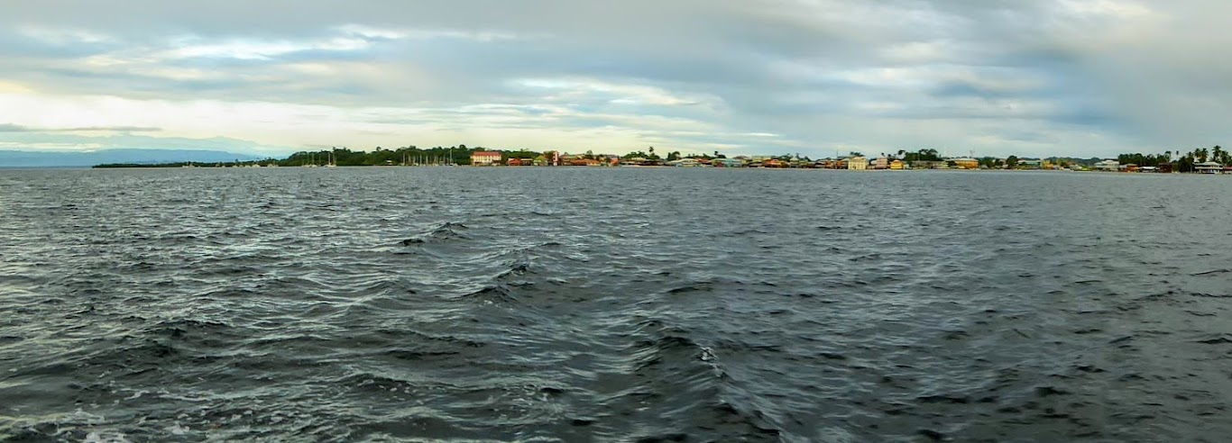
We raised anchor at dawn, saying a final farewell to Bocas Town, as it faded out of sight.
Our next stop would be Escudo de Veraguas, a remote island located ten miles off of mainland Panama. Until 1995 the island remained largely uninhabited; but in recent years, fishermen from nearby coastal towns began using the island as a base for fishing parties, and later settled permanently.
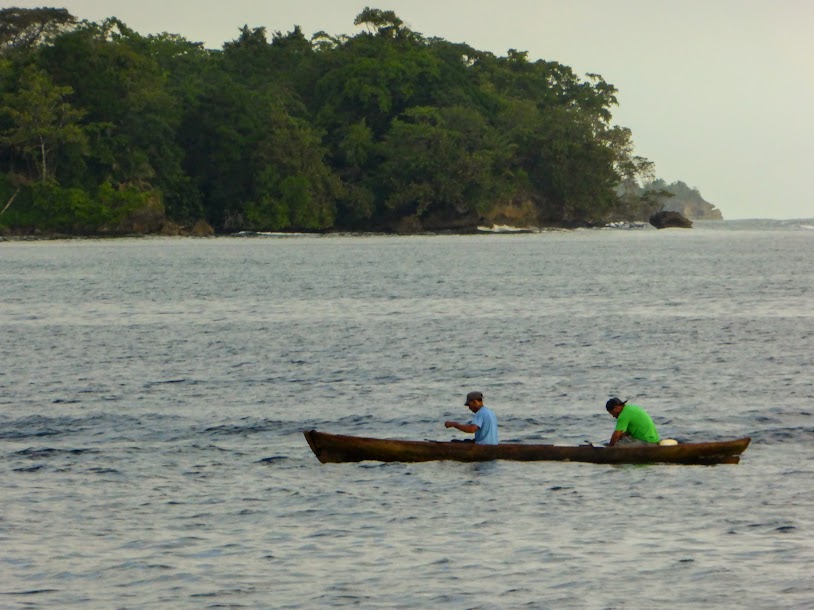
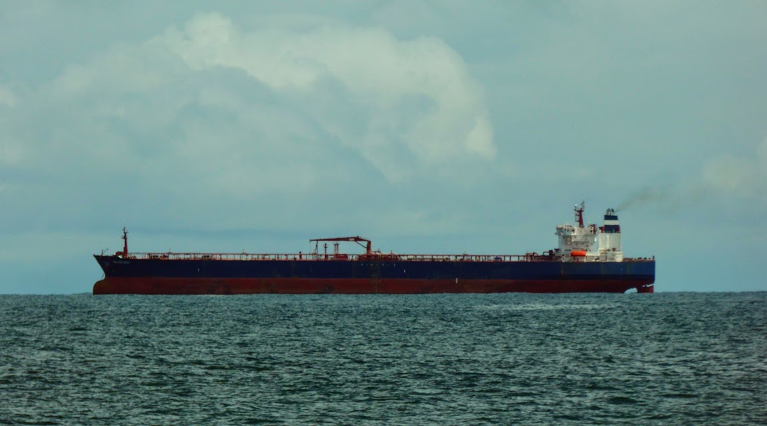
It was a short, eight hour, uneventful run. We passed local fisherman along the way, and the first large, commercial tanker since traveling off the U.S. coast.
The skies threatened to rain most of the way, but as Escudo de Veraguas came into view, bright sun broke through to welcome us.
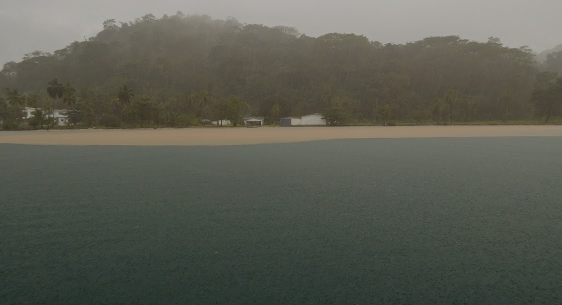
We approached the island’s west side, but with winds predicted to blow from the northwest, Scott chose to move around to the south side, providing us more protection at anchor.
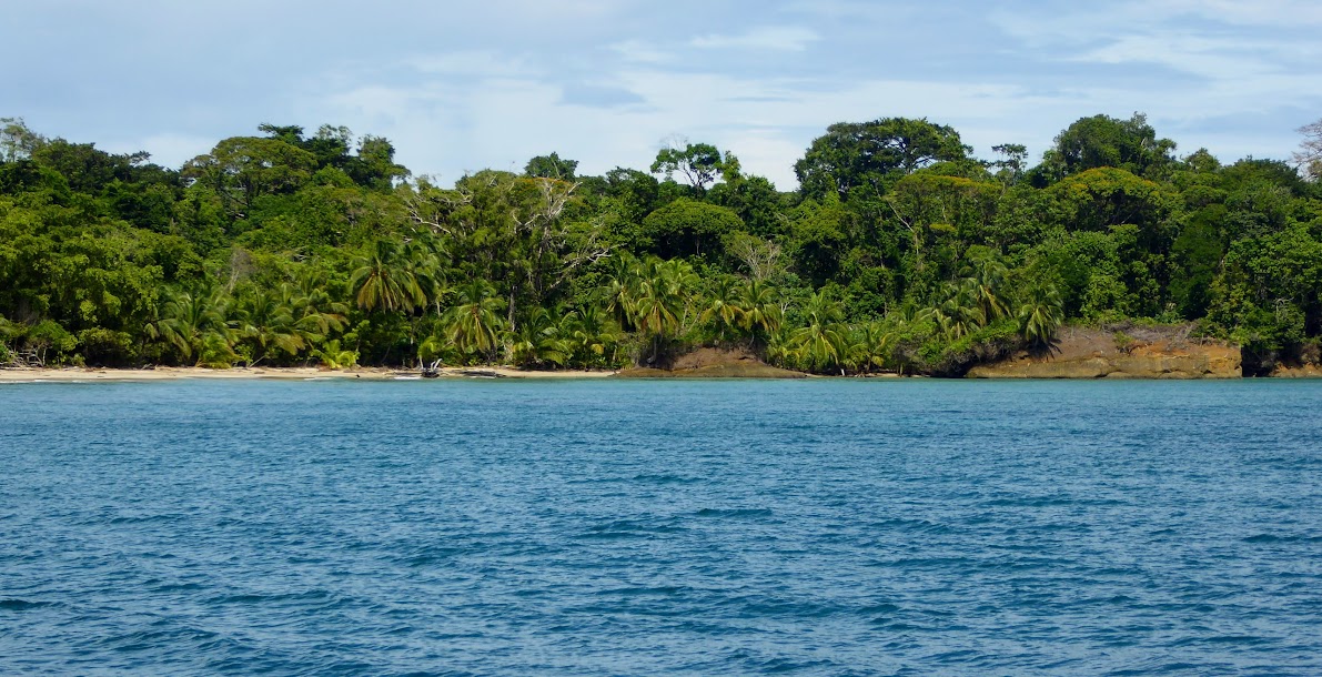
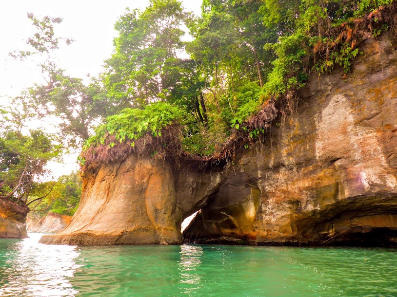
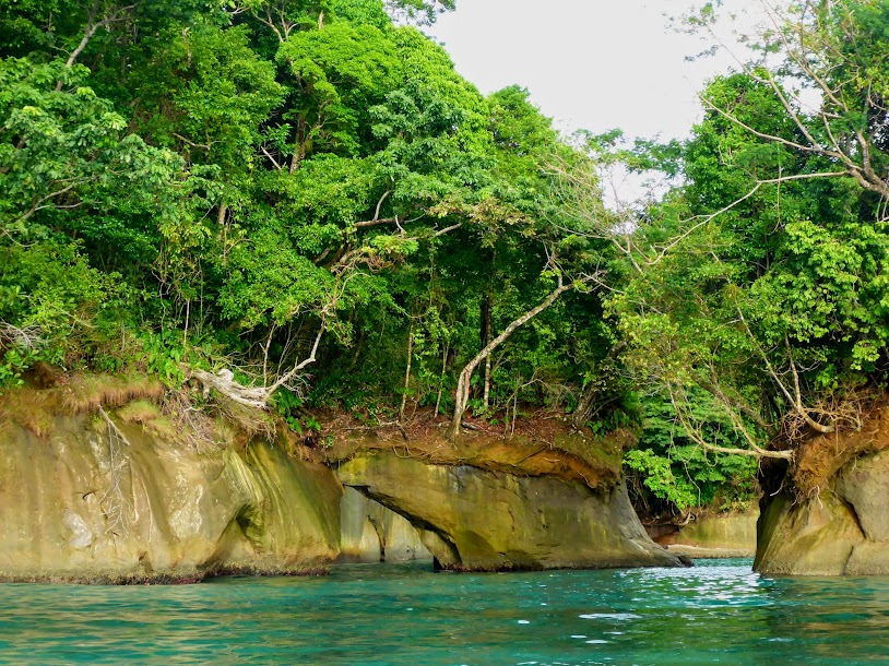
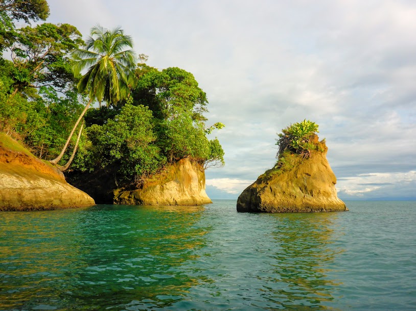
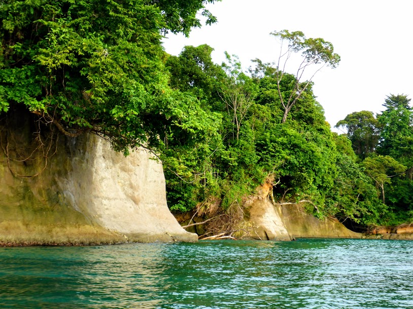
As we rounded the corner, sandy beaches gave way to beautifully interesting rocky coastline. We had the place all to ourselves and enjoyed mountain views of the mainland in the distance, and gorgeous Escudo de Veraguas off of our starboard side.
Scott took the dinghy out to investigate. He soon returned, and insisted that I drop everything and come out with him. Stop cleaning, and preparing dinner….no problem!
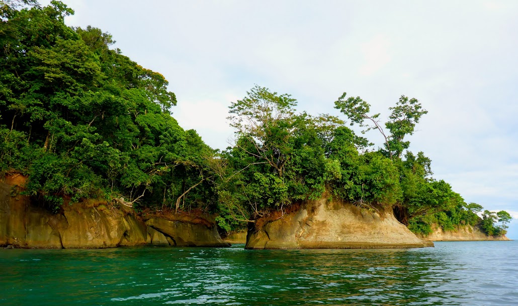
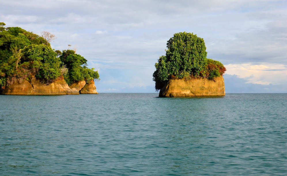
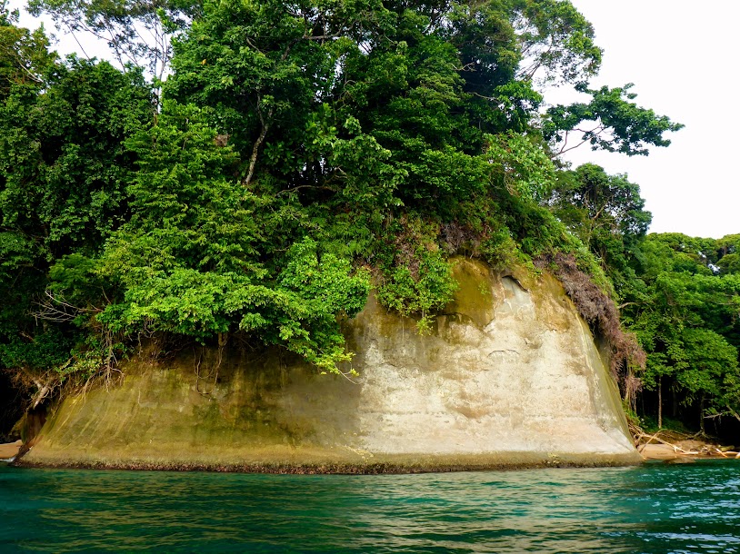
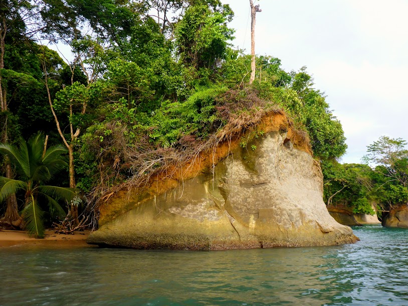
The coastline here is like something Walt Disney dreamed up. Rocky shores and islands, both smooth and jagged, topped with trees of all textures, types and sizes, that melt into clear green-blue water.
Lush, green foliage covers the tops of some formations, like a thick head of hair.
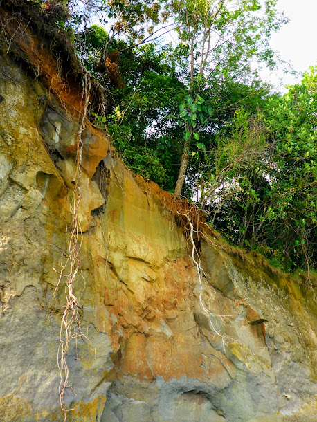
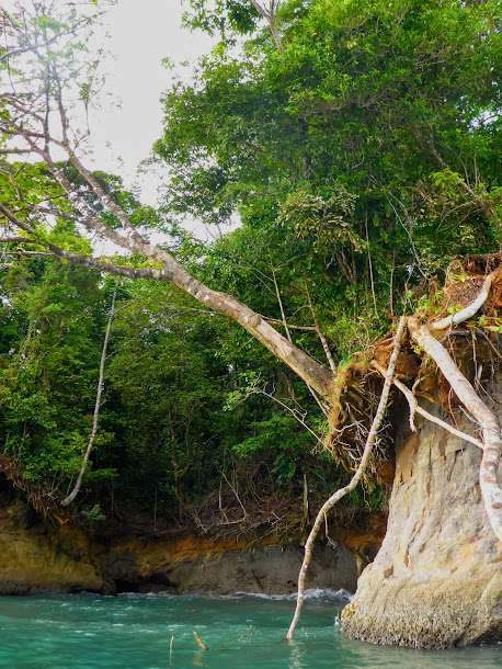
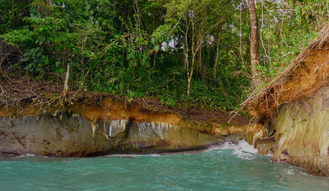
In other areas, trees dangle on, or off of, the edge, their roots trailing down below. We’re not sure how these things manage to survive and grow!
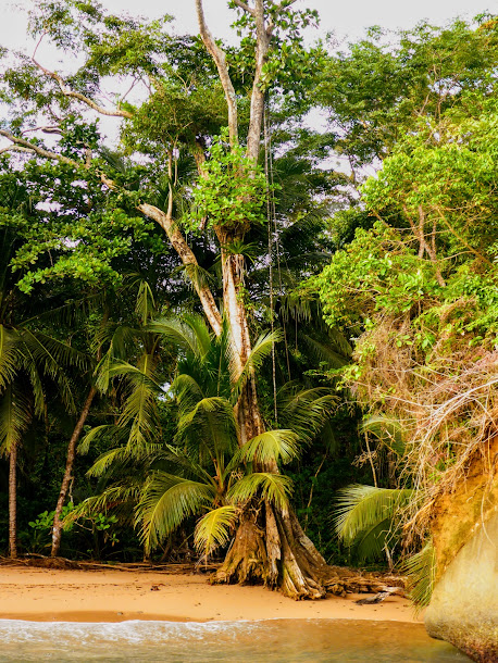
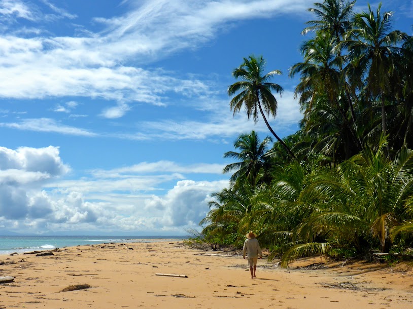
Along sandy beach areas, trees seemed rooted in air.
There is a clear line between soil and rock.
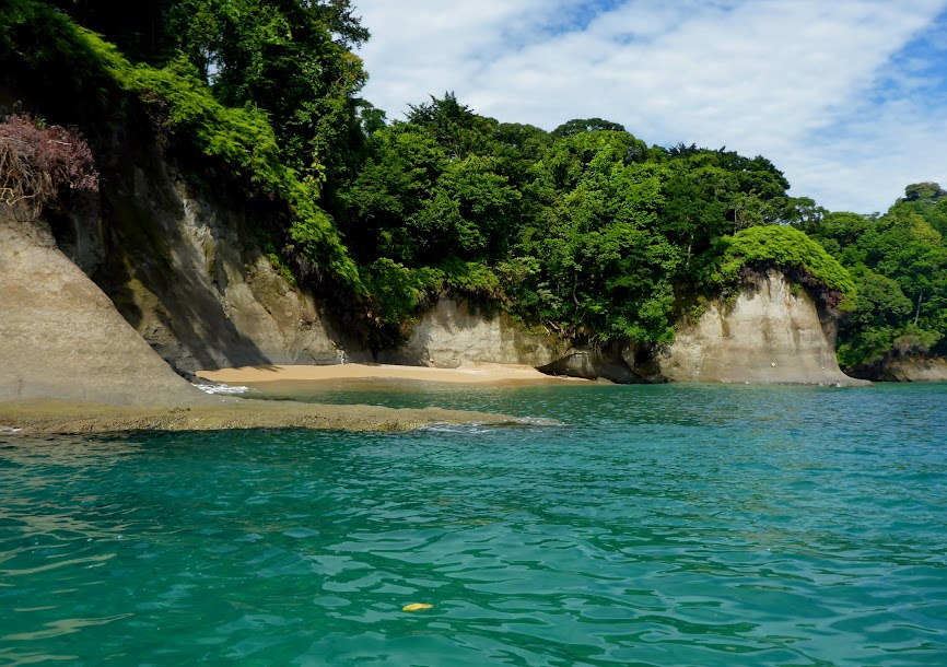
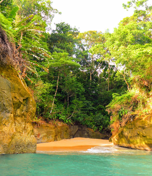
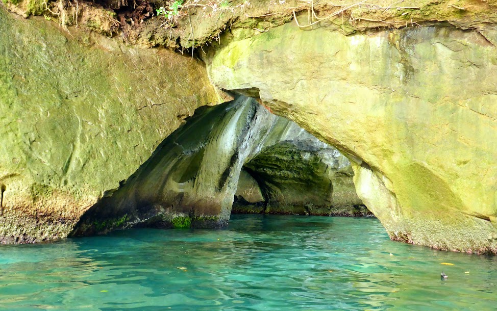
We wove in and out of nooks with small beaches, under rock arches, and past narrow caves.
The area reminded us of calendar photos we’ve seen of Indonesia’s rock islands, in the western Pacific Ocean; it was truly other-worldly.
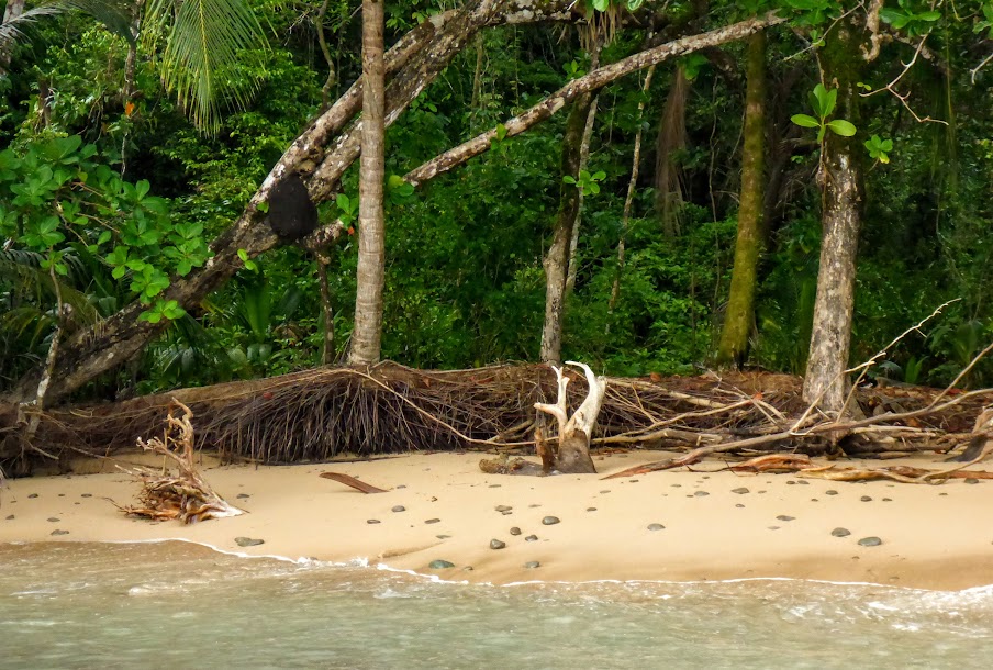
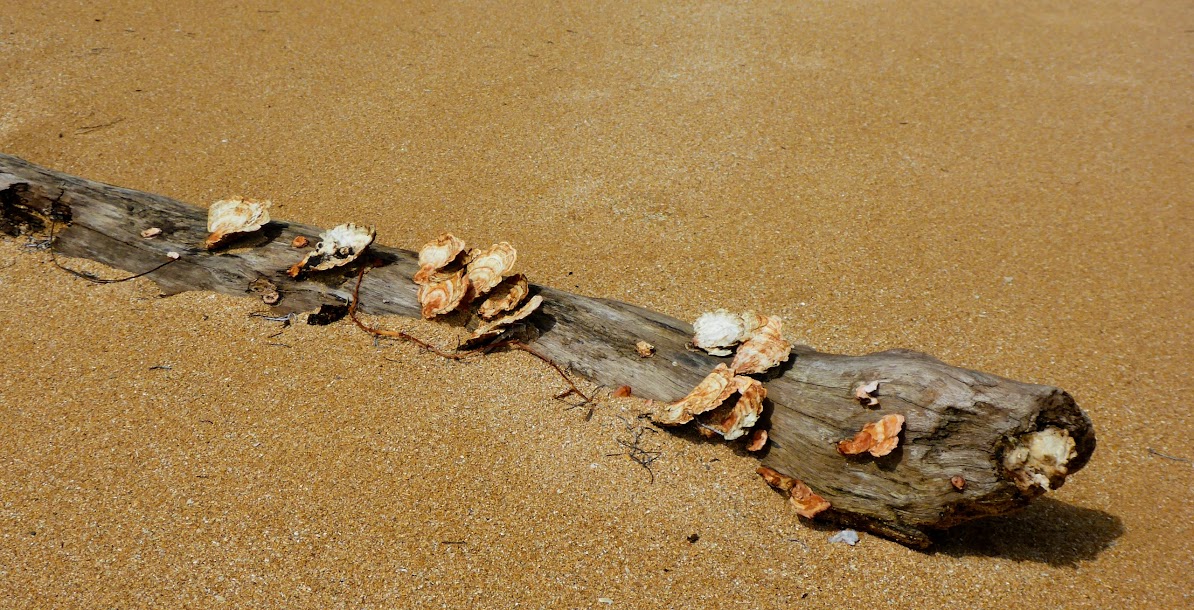
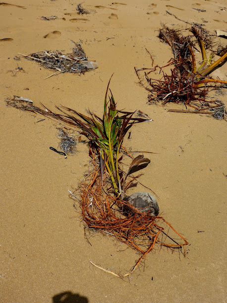
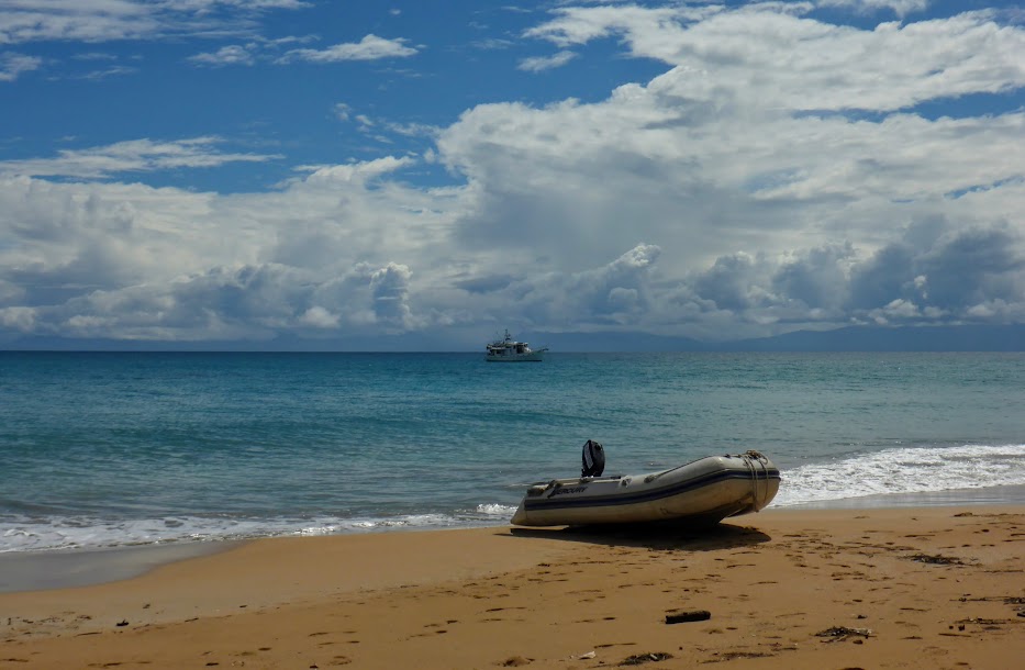
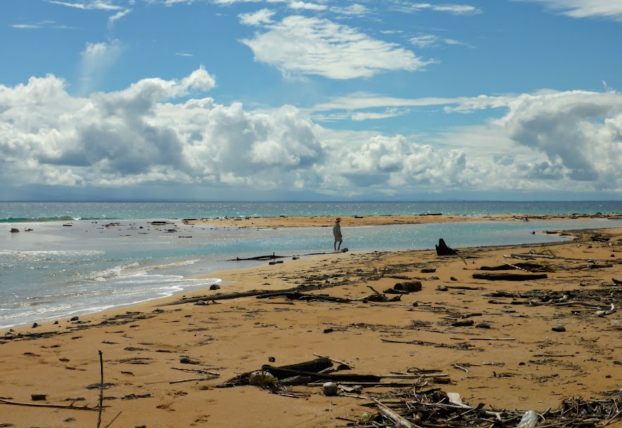
We enjoyed time on the long, sandy beach off of our bow. It was covered in lots of interesting, “natural” trash; logs, rocks, shells and many loosely rooted coconut palms.
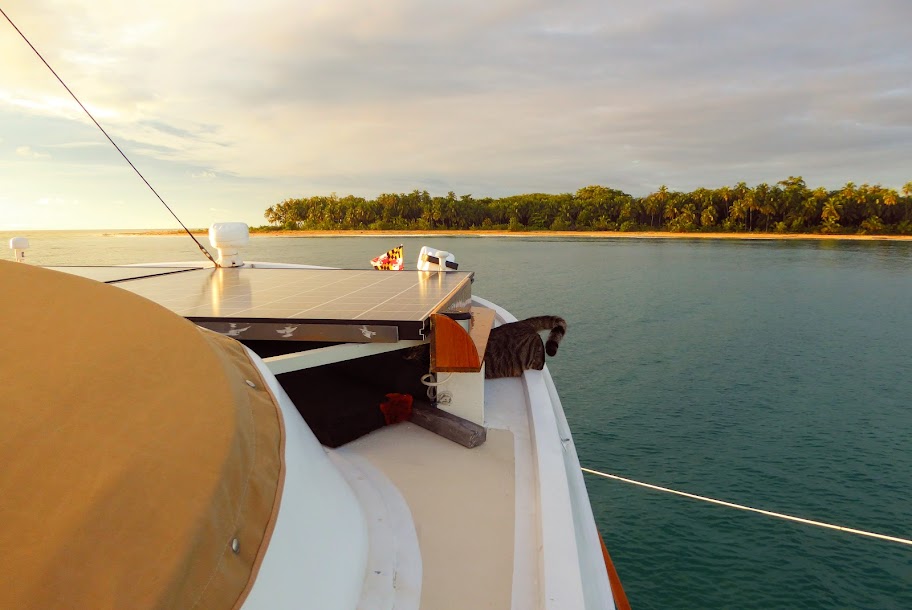
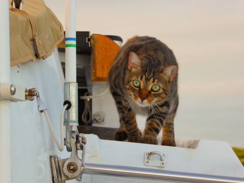
Howard loved the quiet anchorage, free from noisy pangas. He enjoyed happy hour up on the flybridge with us, and considers it his domain.
Sea Life is sporting a new look these days:
The idea came from a van we saw parked in Bocas Town, with stickers from countries it had visited. Scott got to work ordering stickers, and we also took the opportunity to plug the blog as we travel.
We hated to leave Escudo, but while winds and swells were down, it was time to keep moving. Here are many, many more photos of this beautiful island.
“Shells Sink, Dreams Float. Life’s Good On Our Boat!”