A Rainy Day In Beaufort, SC

We chose to take the Intracoastal south, to Beaufort, SC, instead of making our way to Florida in the ocean. Here’s why:

Here’s why we’re waiting until tomorrow, to go out (we’re the green dot):

It’s steady raining here today, so we’re laying low. We’ll leave tomorrow afternoon, for a 24 hour or so run toward Fernandina Beach, Fl.

“Shells Sink, Dreams Float. Life’s Good On Our Boat!”

Squeezing South Toward Beaufort, SC

<< Previous | Next >>

This morning, we left Charleston at about 9:30. Scott was aiming for slack tide (when the tide is neither coming in or going out, resulting in near zero current), making it easier for us to get out of our slip. The currents around the marina make docking a challenge.

We  had planned to go out of the inlet, and do an ocean run to Fernandina Beach, Florida, but the weather isn’t cooperating.

Lesson courtesy of Scott, dumbed down by me:

There is a strong low pressure system off of the coast, causing stronger than normal winds, and bigger than normal waves. Usually, a high pressure system will come along an move it, or the natural progression of weather will move it off shore. However, this thing is stubborn. It won’t move, and has had the eye of the National Hurricane Center. However, by all accounts, it should be out of our way by the weekend, allowing us a more favorable ocean passage.

In the meantime, instead of paying for three or four more days at a slip, we decided to weave our way south toward Beaufort SC (I was recently reminded by my good friend, and experienced cruiser, Sue, that you are always headed toward somewhere, and not to somewhere, never knowing what weather and water will bring). The Intracoastal from Charleston south is in sad shape. It hasn’t been kept up well, due to the economy, and budget restraints. It has many areas that have “shoaled,” or filled in, from here all the way through to south Florida. Sea Life draws more water than our last boat, so we have to be even more careful than normal navigating this time.

Our plan is to hit the shallowest points at higher tide, getting the best water level. So far, we’ve squeezed through two of them. Scott meant to photograph one area, where the channel markers are clearly off of where the “pink line” of the chart plotter tells you to go. He’s always preaching to me to watch the water and the depth finder, as opposed to the “pink line,” and today is a reason why. So far, we are snaking through just fine, even after passing this channel marker that is almost completely submerged, at low tide. At high tide, it won’t be visible at all:

Good thing Howard is “happily” on watch:

We’re seeing many oyster beds along this route. They are very visible, with the big tide change in this area. Unfortunately, you cannot eat them, as they spend too much time out of the water. Fortunately, there are a great many of them, resulting in cleaner water!

The hope is to make Beaufort, SC this evening, but depending on tide and current, we may settle for somewhere north of that. We don’t intend to go into Beaufort, choosing to do a night or so on a mooring ball. I’m still wading through things here on board, finding permanent places for toiletries, canned goods, etc. A day at anchor, with no landfall, allows me to catch up a bit. On Friday, we plan to head out of the Beaufort inlet at midday, for a 24 or so hour run to Fernandina Beach inlet, which is just inside the Florida border.

We don’t plan to be at a marina, plugged into power and with endless water, for another 2-3 weeks, so this will be a good test run for the near future of our life “on the hook!” Here are more photos.

“Shells Sink, Dreams Float. Life’s Good On Our Boat!”

Our Tour Of Charleston

<< Previous | Next >>

Yesterday, we took a two hour walking tour of the city with John, from Charleston Strolls. We learned quite a bit:

Charleston (Charles Towne) was named after King Charles of England. He gave all of the land south of Virginia, north of Florida, and west to the Pacific to his eight best friends. Pretty great of him, considering he didn’t own the land! The friends originally settled up the Ashley River, which borders Charleston to the west. The mosquitoes wreaked havoc on them, with yellow fever and such, so they moved down river to Charleston city.

The city was originally walled, for protection from Indians, pirates and the Spanish. It was one of three walled cities in the region at the time: Charleston was the British walled city, Quebec was the French walled city and St. Augustine was the Spanish walled city.

People of any and all religions were free to live and practice in Charleston, as long as they paid their taxes. The money went to fund King Charles’s church, St. Phillip’s Episcopal. In the 1700s, the church was badly damaged by a hurricane, and a second St. Phillip’s was built just a short distance away. Less than fifty years after it’s opening, the congregation at St. Phillip’s grew so much, that St. Michael’s episcopal was built at Meeting and Broad streets, the original location of St. Phillip’s.

Charleston was the nation’s capital of the slave trade, the place where many of those enslaved people first landed in the New World. About 40 percent of enslaved Africans brought into the country passed through Charleston Harbor. The city was built on slave labor and, for nearly 200 years, thrived under a slave economy.

Considered the grandfather of long grain rices in the Americas, Carolina Gold rice became a commercial staple in the coastal areas of Charleston. Originally seeded in Madagascar, it’s a delicate,  non-aromatic rice with “chameleon” starch properties that allow it to mimic creamy risotto or sticky Asian-style rice, depending on how it is cooked. It brought fortunes to those who produced it. Most of the big houses in Charleston’s Battery were built by those owning rice plantations.

There are nine or so cobblestone streets left in the city. One of which was once called “Labor Lane.” Women would be driven up and down it in a horse drawn cart, in hopes if inducing labor. Not sure of the success rate.

Traditionally, houses in Charleston were only one room wide, and extended back several rooms. This allowed you to open up the windows on each side of the house, and get breezes from the water moving more easily through the house. People spent a lot of time on their porches, or piazzas as they are called here. They were used for eating dinner, entertaining or sleeping in the hot summer evenings.

Kitchens were separate from the main house, and built of brick, to help prevent the house from catching fire. As servants brought food to the main house, dogs would bark and jump up, trying and get to it. The servants would toss the dogs little balls of fried cornmeal to keep them quite….hush puppies! (we have heard of this in more than one southern town)

Elliott Street was the red light district in old Charleston. In the 1700’s, the women who worked the area were made to wear red shoes to distinguish them from the “proper” women of Charleston.

Baskets made of sweetgrass have been part of the Charleston area for more than 300 years. Brought to the area by slaves who came from West Africa, this basket making is an art form which has been passed on from generation to generation. Today, it is one of the oldest art forms of African origin in the United States. Charleston, and some areas around it are the only places where this particular type of basketry is done outside of Africa.

Functional baskets for everyday living were made by women. They were used for bread, fruits, sewing, clothes, storage, etc., and made from the softer, pliable sweetgrass because of its pleasant fragrance, similar to the smell of fresh hay. The baskets are very labor-intensive to make, and therefore very pricey. They were beautiful, but out of our budget.

After the tour, we rode our bikes to Harris Teeter, and parked them there for a grocery run. But first, we called an Uber cab to take us to TACO BOY! Scott found out that they have a Charleston location, and he had to have more tacos, so off we went.

We enjoyed the same great food and atmosphere, and then headed back to Harris Teeter for a small food run. Several evenings before, we met our favorite Uber driver, Corbin, who spent many years in Baltimore! We used his club card number, so he could get the gas points that Harris Teeter offers in Charleston. From there, we biked with our groceries back across the peninsula to our boat, where we unloaded and prepared for our am departure south.

Here are a few photos from our stay in Charleston.

“Shells Sink, Dreams Float. Life’s Good On Our Boat!”

Catching Up In Charleston

<< Previous | Next >>

We’ve been here in Charleston since Wednesday am, and it’s been a low key week so far.

After having dinner out on Wednesday evening, we didn’t leave the marina for the next two days. Thursday was mostly a rain out, and Friday wasn’t too much better for most of the day. We used the time to clean the boat.  I worked inside, and Scott did outside, washing the ocean salt off of Sea Life. I also did laundry, and spend hours, and hours and hours pouring over our refit photos to post them. We have spent time with others who are here at the marina. And have enjoyed meeting the locals.

On Saturday am, we rode our bikes to the Charleston Farmers Market. It’s spread out in Marion Square, a park in downtown Charleston. They had several farmers’ stalls, as well as crafts and food. We bought some delicious soda from Cannonborough Beverage Company. It’s made in Charleston, and the flavors are awesome. We had Grapefruit Elderflower…tae-sty! They will soon be shipping their yummy, fresh-tasting soda, so check them out!

Aside from the soda, we bought some fresh ravioli, vodka sauce, veggies and some pastries. After we were through shopping, we grabbed something to eat at one of the food stands, and went to watch some break dancers that were performing. You may be poo-pooing the idea of break dancers, and so would I, but some of these guys were really terrific. We watched one of them do a back flip, and jump over seven people!

Late Sunday afternoon, we did a short pub crawl, visiting the Blind Tiger Pub, Tommy Condon’s and The Griffon. They all have a great atmosphere, and we enjoyed scenic walk to each one, cutting down alley ways, and peering down scenic gated walkways.

Yesterday, we rented a car and made stops at Home Depot, West Marine, Petco, etc Once our errands were finished, we found ourselves 20 minutes from Folly Beach, so we headed there for lunch.

Folly Beach is a great little beach town. It sits just south of Charleston, and is made up of approximately 18 miles of land and 6 miles of water. There are only two hotels to speak of, the rest are inns and private rentals. Route 171 is the town’s main drag, and has a perfect amount and mix of beach stores, shops and restaurants (all with great outside seating). In addition to renting bicycles, you can also rent golf carts….this earns a big nod from Scott! There is also a terrific fishing pier, complete with rod holders, cleaning stations with sinks and an elevated viewing level.

We started our visit by stuffing ourselves at Taco Boy. The food here is fantastic!

Taco Boy - Folly Beach, SC, United States. Taco Boy (Folly Beach, SC)

Taco Boy - Folly Beach, SC, United States. Front of the bar area

From there, we walked around the corner to the Surf Bar. It was a neat, dive-looking place, and I was anxious to check it out. Sadly, they open at 4 pm, so we kept walking. Our next stop was Rita’s Seaside Grill, where Steve made us some delicious drinks! They use a lot  of fresh juices in their drinks, and unusual ingredients (honeysuckle vodka…yum!), and the end result is great. We didn’t eat here, due to our Taco Boy stuffing, but it smelled terrific there.

After leaving Rita’s, we walked out onto the fishing pier which stretches way out over the ocean. There were many people fishing all along the pier and at the end of it.

Scott and I walked to the end of the pier, and up onto the observation level, before heading back to our car. We drove back to Charleston, with a plan to return to Folly Beach in the future, for a longer stay!

“Shells Sink, Dreams Float. Life’s Good On Our Boat!”

Our First Ocean Leg: Beaufort, North Carolina to Charleston, South Carolina

<< Previous | Next >>

Please forgive me, this one is long. A lot of hours and details to cover…settle in.

Our ocean journey took us out of the Beaufort inlet, and then straight for a point off of Cape Fear, where we would make a turn to put us in another straight line before making the turn toward Charleston inlet and harbor.

I started out planning to document our ocean journey every so often, save it in  my lap top, and then just upload it to the blog when were in internet range again. It was a good idea, just not feasible at the end of the trip. Here’s what I started with:

6:30 am: We planned to leave at the first crack of light on the 15th. When the first crack of light came, it became clear that we weren’t the only ones with this plan. Two others boat near us fired up their motors, and other stuff went past the docks as well (ferries, fishing boats, etc). We waited until the big guys left, to avoid them passing us while pushing a wall of water in front of them, and leaving a painful wake.

7:00 am: The Beaufort inlet is very wide, much more so than what I’m used to in Ocean City, MD. And, thankfully, there is much less traffic coming out to fish. We are currently officially in the ocean, and things are good!

7:30 am: At 6 am, I gave Howard something to “calm” him, and hopefully prevent nausea, as we’ll get more “roll-ly” toward the end of the day. At first, It took the edge off enough that he wanted to walk around, jump up onto the “dashboard” area of the helm, go downstairs to look for food (he can’t have any for 6 hours), wander around the saloon and jump up onto the counters. All while wobbling around, and just missing falling and cracking his head. He is now fighting a coma sleep, with much eye squinting.

8:00 am: We are currently in one foot waves and 3-4 foot swells. There are almost always swells in the ocean, caused by far away winds. We don’t have any weather to speak of where we are, but weather happening farther north drives the swells south. This happens all over the ocean. In addition, local wind causes waves to develop on top of, and along with the swells. For the moment, this swell/wave combination is very tolerable.

12:26 pm: My 7 hour watch started at noon. I took a nap for about an hour, while Scott was on watch. Trying to sleep is a bit weird. The rolling motion below is  not completely from one side or another. Compounded by the noise of the waves and water down below, it was unnerving.  At Scott’s recommendation, I laid diagonally in the bed, to try an offset my movement. I wasn’t rolling all over the place, but  definitely moved. I didn’t get into a deep sleep, it was more of an in-and-out nap-state. It would have to do, because I wanted to allow enough time to wake up and go over some things with Scott, before my watch.

When I came up, Scott was munching on pasta salad, and watching a movie. Since there are no immediate things to watch for, this is completely feasible. He’ll watch for 20 minutes or so, and then pause it, to check horizon, instruments, radar, etc. He showed me what to be aware of on the radar, and we set up our two way radios, so I could wake him up if needed, without going downstairs. He went off to sleep, and I’m with Howard, who is now in a full-on coma.

Ok, so the thought/sight of the water depth and distance from shore that I was concerned about is not affecting me, which is great. So far, the movement is very tolerable. Every few minutes, swell and wave sync up, and we do a pretty good roll from side to side. We have the doors on either side of the pilot house open for ventilation, and there is considerable surf noise; makes sense, considering we’re rolling around and traveling through water!

The water color is gorgeous blue, with maybe a tinge of green. I’m sure our photos won’t do it justice. The color of the surf at our side, and in our wake is pure white, unlike the tea-brown of the Chesapeake. The Dismal Swamp was brown, but that was from tannins in the water. The good old mid–upper bay color is from pure ick. The water is also really, really clear. You don’t notice how clear, until some brown sea grass floats by (again, pretty brown), and it just pops in the clarity of the water.

We, especially Scott, are seeing a ton of flying fish out here. They are almost translucent in color, and their wings flap like some kind of remote control toy. Sometimes whole schools jump off to our side. They can really get some distance.

I have seen two boats pass us on the horizon, so we’re not the only ones out here. So far….ok.

That’s all I was able to “pre record.” Here’s the rest:

My watch was pretty uneventful. I got used to the rolling, which varied from side-to-side, to corner-to corner and back to front; it was never severe or jerky. As I mentioned before, there isn’t anything immediate to watch for. We only had to make two or three course changes, and there was little to no other boat traffic. What there was, never got closer than the horizon.

This made it very easy to leave the pilot house to use the bathroom, make something to eat or drink, etc. I also used the laptop to pour through our refit pictures (which will be added to the blog soon!) Scott slept off and on. He also did several engine room checks, spent time out on the bow and in a chair in the cockpit (one of his favorite spots to view the waves).

Eventually, we deployed the paravanes, with stronger winds predicted overnight. The “bird” in the water is actually 15 feet below the surface!

The birds make a vibrating sound, as they go through the water. It almost immediately drew a big pod of dolphins. Some were huge! They stayed and played of of our bow for at least an hour! Video coming…currently having technical difficulties.

We made our turn off the coast of Cape Fear, at Frying Pan Shoals before dark. There is a shorter route, closer to shore, but it also takes you closer to the shallow water. Swells can get pretty nasty there, so we chose to stay out in the deeper depth, and take a bit more time. We had no problems passing by. Now we were on the second straight course to Charleston inlet.

By 6pm, it was time for Howard’s second dose of “calming” meds. Since the first dose had worked so well, and we still had 18 hours left to go, I wanted to keep on schedule. Getting dose number two wad way more of a challenge. I tried mashing it up in some avocado, and putting it down his throat. This worked great the first time, but now he was wise. Then I tried dissolving it in water, and giving it to him with a dropper. I think a drop or to got into him, the rest went everywhere. I finally went back to the avocado, with more force, and was successful.

His second transition was much worse. I think that with all of my trying, I may have given him more than the required dose. In addition, I think that dose one was still somewhat in his system. He stared off for awhile, eyes slits and mouth a gap. Then he jumped to the floor suddenly (again, nearly cracking his head), and wobbled to the steps. I was betting it was the litter box that he was after, and I was right. The poor thing could barely stand up long enough to do what he had to, before slumping down in the litter. I pulled him out, cleaned him off, and placed him on our bed, making a pillow nest around him. Thankfully, he stayed there and the drugs leveled off.

My watch ended at seven, but I stayed up with Scott until it got dark. I wanted to avoid a panic attack, coming up at midnight to pitch black all around me. “Nautical” dark happens considerably later than on shore. I watched it slowly come on, and went down to sleep  at about 8:30, before pitch black happened….too tired.
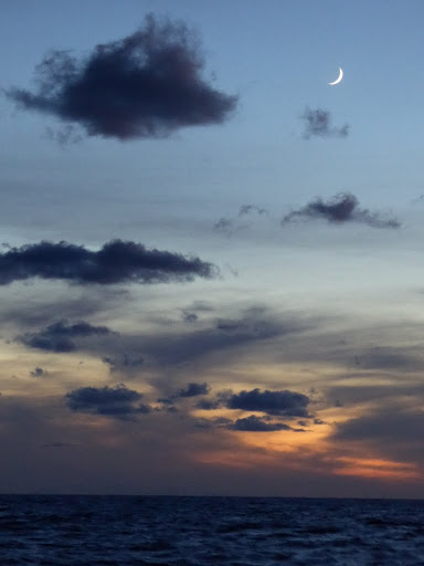
At 10:30pm I came back up into the pilot house, wanting to give myself enough time to come awake (after more nap-sleep) before taking my watch. We have dutch doors on either side of the pilot house. Scott had the bottoms secured for the night hours, but the tops were open and our screens were pulled, so you could still hear the waves going by us in the dark. The darkness and sound of the waves outside the doors was pretty creepy to me. Scott was getting pretty tired by 11:30, so I told him to go ahead and sleep; I would start my 12-3 watch early. I asked him to sleep on the bench eat to me, because of the creepy factor.

Eventually, I became used to the night noises. We actually had some light pollution off of the starboard side; port side black. The moving horizon would catch my eye, making me realize that we were in a big roll. I decided to stop looking out. I’d check the radar and the other instruments, and then focus on things inside.

We had our ipod hooked up to the pilot house speakers, so I played a “mix tape” of songs. I kept the volume at sleep level for Scott, and dusted off some stuff I hadn’t heard in awhile (Better Than Ezra and Crowded House – a nod to my Bussing Court roommates!). I also chose to stand versus sit, to keep more awake and alert. Focusing on the music and my dashboard tasks kept my mind off of the dark rolling ocean outside, and I was on watch from 11:30 until about 3:15 with no issues. I woke Scott up, and went down to try and nap.

Scott was on watch until 6 am, and then it was my turn again until noon. Keeping the watches shorter overnight reduces the chance of falling asleep. Case in point, by the time I came back upstairs, Scott was fighting sleep. I came back up at 5:30, wanting to watch the sunrise. By now, I was very ready for light; it took forever (nautical dawn). The winds had increased overnight, so I was now nervous about the state of things outside the windows once it got light.

Today, was my birthday, and in addition to being irritated that the sun was taking so long, I was also complaining that I’d ushered in my birthday on watch in a dark ocean, and would be spending the next several hours still at sea. Scott surprised me with a slice of peanut butter pie, with a candle in it. Yum! That should hold me over.

We’d been hearing thuds outside the boat throughout the night. Scott discovered that flying fish had crashed into us, and to their death. In the am light, we discovered more than a few casualties!

We were now in bigger swells (6-7 feet), so I again asked Scott to sleep on the bench. The idea of him right there was calming. After an hour or so I acclimated, and told him to go down below.

My nap sleeps were catching up with me as well, and I was having trouble fighting sleep as I tried to do some computer work, so I went back to the iPod music plan. Food was also not cutting it; I wasn’t seasick, thank goodness, but just felt off.

At about 9 am, things started to deteriorate outside. Scott was up, so he took over, as we had to start  making our turn to Charleston inlet. We turned bit by bit, to reduce the amount of time that the boat had to be in a beam sea (side to side, everyone’s least favorite). Eventually, Scott told me that we were in for 90 minutes or so of nasty crap. Since he didn’t need me (thank God), I went down below with Howard. If I can’t see the big waves and impending pitching of the boat, it’s better for me.

For the better part of the next two hours, Scott maneuvered through 8 foot swells, with 2-3 foot breaking waves on top of them. Autopilot is useless in situations like this, so he was steering by hand. He said it was like driving over cargo vans. He admits that he was quite nervous about it at first. He’d steered in seas like this on a sailboat, but not in this boat. At one point, he looked over to the pilot house door, and saw a wall of water. He was convinced that it was coming inside, and right for him, but the boat rolled up, and then back down away from the wave.

Luckily, I didn’t notice nearly the pitching and rolling that I’d expected. I was, however, wearing ear plugs. Water that angry is damned noisy on the hull! Howard, who was more alert now, handled it like a champ. In his pillow nest, he didn’t move around, and he did well with the loudness that my ear plugs were muffling.

Sea life handled the sea state like a champ.We chose this boat for it’s hull design and weight, to handle well in big seas, and installed the paravanes to help in these situations. Both decisions proved right, and we were now coming through Charleston inlet, at approximately 11:30am. By 12:30, the motors were off; 30.1 hours after we turned them on in Beaufort.

We maneuvered our way into Charleston harbor, and then Scott slowed to bring in the paravanes. As of now, we are in a slip at Ashely Marina, which is on the west side of downtown. We’ll spend a week here, doing some boat work and projects. I have yet to organize the cabinets in both heads (stuff is just shoved in there), and our guest stateroom looks more like a basement, with all of the stuff that’s been thrown in there “for now.”

I ushered in my birthday on watch in the pitch black ocean, so once we got tied up and cleaned up, Scott took me out for a birthday dinner. He took me to FUEL in Charleston, where he’d eaten when here for a conference. It’s located in an old Esso gas station building. The atmosphere, food and service were all awesome. I highly recommend it: http://www.fuelcharleston.com/

Here are the photos of our ocean leg…before things got too dark and then too bumpy.

“Shells Sink, Dreams Float. Life’s Good On Our Boat!”

Happy Ocean Birthday To Me!

<< Previous | Next >>

We arrived in Charleston, SC at approximately 12:30pm today, after a 30.1 hour ocean run from Beaufort, NC.

It’s my birthday today, so we washed off the last 30 hours, and are headed out for something to eat. I hope to stay awake long enough to eat, and to get some birthday time away from the pilot house!

I will post details of our journey here tomorrow!

“Shells Sink, Dreams Float. Life’s Good On Our Boat!”

Beaufort, North Caroline

<< Previous | Next >>

Beaufort is a nice little town, and has gotten even better in the seven years since we last visited. We got a slip at Beaufort Docks. Just on the other side of the piers is a small boardwalk that runs the length of the dock, with some restaurants, parking and a shop or two. Across the street from the boardwalk area is Beaufort’s main street, lined with many more shops, restaurants and such. The area is all very walkable, but we got our bikes off of the boat and rode through the side streets, admiring the houses and getting our legs moving a bit.

We made sure to stop in at Backstreets Pub, a great little dive bar that we visited on our previous stop to town. Being Sunday evening, we had the place to ourselves. The bartender served us, and then went back to work scrubbing and cleaning the outside patio..I mean scrubbing, even the bricks! I’ve never seen a dark, divey bar so clean! The various stuff hanging around had dust on it, but you could eat off of the floor, even in the corners! Scott spilled some beer onto the bar, and I jumped up to get some paper towels from the bathroom, to wipe it up! I felt terrible about our peanut dust on the floor (we were given cups to deposit the shells).

The bartender then sent us to Queen Anne’s Revenge for dinner (Backstreets doesn’t offer any food, just the peanuts). It is located in one of the buildings directly across from our slip…perfect. We sat at the bar, where Joe, the bartender, introduced us to a tasty beer called Red Oak. It’s delivered cold and kept cold. He told us that Coors was handled the same way when it was first released.

We chatted with Joe while we drank our beer, and waited for pizza to go. He sent us on our way with two bottles of Red Oak, from his private stash (the bar only sells it in draft). Thanks Joe!

We spent today (Monday) preparing for an offshore run to Charleston, SC. Scott did some motor maintenance and checks. I did a small grocery run, and go to use one of the trusty “70s (ok, maybe 80s, I’m bad with cars years) flash-back” courtesy cars.

Fred, at Olverson’s still has these guys beat, as you can just jump in a car and go, keys in it. Here, you have to sign these beauties out. Use is limited to an hour at a time, and you are asked to replace any gas used Fair enough, but I have to walk two blocks to where the cars are; take an orange cone off of the roof; spend five minutes or so trying to figure out how in the world to move the seat forward, because I am miles from reaching the pedals (for possible future reference, it’s a mechanical control…on the door); place orange cone in parking spot, to save it; drive the ten minutes or so to the store; maneuver an unfamiliar store; check out, with a wait for a register glitch; drive back; find a gas station; fill tank with some gas; drive to meet Scott with the dock cart, so he can take the groceries to the boat; take car back to spot; remove cone to park in spot; place cone back onto roof and walk back to dock office. That takes more than an hour, no matter how you cut it. I took 75 minutes, door to door. Luckily, they let me slid..whew. I’m glad we’re not staying long, and I only had the need for one courtesy car run…too stressful!

I also hit the local laundromat across the street, to wash some blankets and rugs. You walk your laundry through the general store, past people ordering fudge and ice cream, and perusing t-shirts and trinkets, to the laundromat our back. Again, eat-off-the-floor clean. While waiting for the washing and drying to finish, I shopped some of the main street stores.

Scott and I did another bike ride, and then loaded them back onto the boat, before heading to get something to eat at Clawson’s. It’s located in an old bank, and has a neat interior, with a lot of the details still intact. We ate in the bar, and Danny served us. He was great, and even gave us an extra large take-home size of the house made ranch dressing…DE-LISH!

So now we head out at dawn tomorrow (Tuesday) for a 30-35 hour offshore run to Charleston, SC. We will  head straight for Cape Fear, and then turn, to curve around the shoal (shallow area) that extends out from it. From there, it’s a straight shot to Charleston. There is only a sliver of a moon tomorrow night. Great for stars, bad for pitch blackness!

We’ll take turns on watch: Scott will start out (6:30am or so), and be on until noon. Me – noon to 7pm, Scott – 7pm to midnight, Me – midnight to 3am, Scott – 3am to 6am, Me – 6am to noon, and then Scott will finish and take us into the marina slip.

If you pray, pray that I don’t panic when I think that we’re 60 miles or so out from shore, or when I look over at the depth finder to see that we’re in 100+ feet of water, or when it’s PITCH BLACK DARK all around us, or, that Scott admits it’s a bit scary and unnerving. If you don’t pray, cross your fingers, toes and eyes!

Be sure to follow our progress on the Where Are We Now? page of the blog! Look for my post, once we’re safely ensconced in a slip at Ashley Marina!

Here are a few pictures of our quick trip to, and in Beaufort.

“Shells Sink, Dreams Float. Life’s Good On Our Boat!”

Traveling to Beaufort, NC

<< Previous | Next >>

On Sunday am, we left our anchorage off of the Neuse River, and traveled just four hours south, to Beaufort, NC, where we got a slip at the Beaufort Docks. We stopped here on our way south in 2007, and Scott stopped here with his friend, Captain Eric, on the way north in 2013, after buying Sea Life in Ft. Lauderdale.

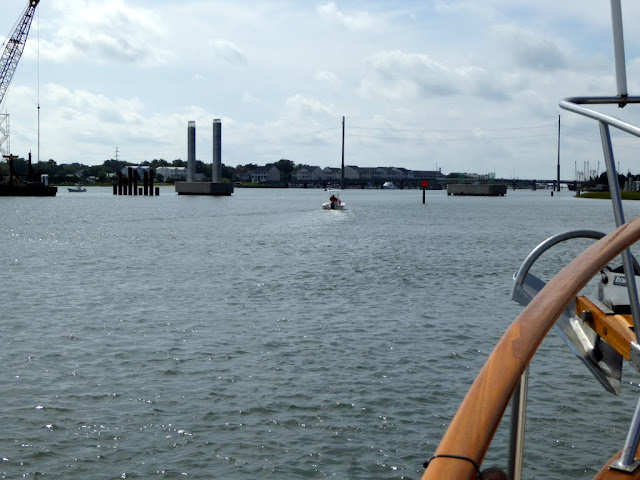
We took a “back way” into Beaufort, which took us under a drawbridge that opens on the half hour. As we came up to the area, it was clear that they are constructing a new, higher bridge, to remove the need for the draw. This is happening more and more along the routes south.

The construction…concrete pilings, barges and such, was strewn all across the channel that we were using to get up to the bridge. And, the markers had been moved to new spots…always keeping us on our toes. So we’re trying to jockey in place, fighting current, while we wait for the bridge, trying not to hit either of the markers or the concrete stuff in our way.

We had previously hailed the bridge tender on the radio, to let him know that we were south bound, and awaiting his next opening. This is customary, although it irritates Scott. He thinks that since we are clearly visible to the bridge tender, they should obviously know that we’re waiting for the bridge. Or, in on-demand cases, he thinks they should see us and open it. If this were true, we’d miss all the “fun” of hailing them on the radio, and waiting for them to respond.

This, more often than not, takes awhile..longer than you’d think, considering that they’re in a tiny space, and right near the radio. You always wonder if your radio isn’t working right, because sometime that happens. They can hear you, and respond, but you can’t hear them, so you keep hailing them. You’re getting irritated that they’re not responding, and they’re irritated that you’re not responding. By the time you get through, or just give up and call them on the phone, everyone is irritated.

But, I digress; apologies. As we’re jockeying, a commercial fishing boat on the other side of the bridge hails the tender that he’s waiting for an opening. The tender informs him that a cruising trawler is waiting on the north side, and that we’ll go through first. The commercial captain replies, (in my best working-man Southern drawl) “ya mean ah yacht?” Now we’re waiting to see his reaction as we come through, and he sees us with our paravanes and such (like commercial fishing boats), and calls us “posers.” We prepare ourselves for radio humiliation.

So it’s now minutes before the opening, and a little boat of idiots anchors to fish…right between us and the bridge!

It may look like there is a lot of extra room, but there’s not, and we’re also dealing with current, which tends to get “wanky” as you go under bridges. We’re also heavy and slow. Good for ocean travel and fuel efficiency, but tricky for maneuvering quickly and in tight conditions.

When said idiots in boat hear the bridge bells go off, to signal the opening, the cobwebs are wiped away, and they realize that they are in middle of the “road”! They haul up their dumb anchor, move just out of our path..and then plunk that dumb anchor back into the water….now their the next guy’s problem.

Ok, we’re good to go, no idiots, bridge opening, commercial guy chomping at the bit to come through on the other side..and a second batch of idiots comes up behind us and cut us off to go under the bridge! Thank God we’re not fast.

Of course once they buzz past us and under the bridge, they see the big guy on the other side, and swerve out of his way…back into our path. Thank God they’re fast, and move across quickly.

We get big “props” from the bridge tender as we go through, “That’s a good hull you got under you, Captain.” It’s nice to get a nod from the locals, and a bridge tender to boot. On to Beaufort Docks!

“Shells Sink, Dreams Float. Life’s Good On Our Boat!”

Alligator River to ALMOST Oriental, North Carolina

<< Previous | Next >>

So remember our trip to Willoughby Bay, just north of Norfolk, where I said that “It’s a hell of a day at sea!”?? Well today, we squashed that. And I mean really squashed it…kinda like this:

We started out from our anchorage on the Alligator River, with the plan to end the day in Oriental, NC. The route takes us from the Alligator River, into the Alligator River-Pungo River Canal, then into the Pungo River. After that, we enter the Pamilco River and then on to the Neuse River, by way of several smaller rivers.

Oriental, NC sits on the Neuse River, and they have a free 48 hour dock for boaters. It’s a small town, with very friendly locals. On our last trip south, a car did a u-turn to pick up Scott and me as we were walking back from West Marine in the rain. Unheard of in Maryland….or just about anywhere else.

Along the way, we decided instead to anchor about 30 minutes from Oriental, and not deal with coming into town to find the free dock full, or worry about having enough water level there (we’ve heard that it’s good for boats with 5 foot and under draft, and we’re 5).

So our day was going fine. The terrain along the way is really cool. A mix of grasses, dead trees and swampy shoreline, with some interesting housing mixed in for extra interest.

As we were entering the Pamlico River, a line of storms caught up with us. Skies got dark, and the rain came on fast, accompanied by thunder, lightening and wind gusts of 38mph. No, this isn’t the “squashed” part.

All in all, though, it wasn’t bad. The winds didn’t kick up the waves much, like you’d think they would. Soon, the storm line passed, and we continued on through the Pamlico River, and eventually into the Neuse River….HERE is where we get squashed.

The wind forecast was for 10-15 knot winds, with gusts to 20, from the southwest. Not an issue for us, as we are heavy, and roll slowly. Quick information, for those who may not know:

The Neuse River is similar to the Chesapeake, in that is an overall shallow body of water. This causes waves to kick up faster and steeper than deeper water. South wind at the base of the bay, near Norfolk, don’t produce big waves (for the most part), as the wind hasn’t had time to travel and build them.

By the time you’re up near Annapolis and Baltimore, however, the wind has traveled a distance, and has built bigger waves. The shallow water also causes the waves to be closer together, or have a shorter wave period. So stronger south winds can be a miserable go in the middle and upper bay. The reverse is true for north wind, which makes things worse by the time it gets to the southern bay.

Ok, lesson over…

So we’re in the Neuse, in the south winds, that shouldn’t be a problem for us, as they are FORECASTED. However, we all know how a forecast can turn on a dime. Instead of winds 15-20, with gusts up to 25…WE, at the flip of a switch, got sustained 25-30 knot winds, which translates into about 28-35 mph winds….sustained, meaning constant. Our gusts were 46 or so mph, and they were often. Another tidbit of note, the power of wind quadruples, when it’s speed doubles…yay for us. You may think that I’m embellishing this..I’m not.

Waves quickly built to 3 and 4 feet, with many 5 footers thrown in. This may not be a big deal to some boaters, and we were in no danger of capsizing or sinking by any means, but it was insanely unnerving. Our bow is eight feet above the water line, and the windows of the pilot house are another five or so feet higher than that. We frequently had waves spraying onto the windows:

Scott installed an awesome paravane system, but we need to be in at least 20-25 feet of water to deploy them. Curses!

A set of big waves would hit, and we’d go UP, and then…DOWN. The down was definitely the more nerve wracking. Scott just kept watching the wind get stronger,  and the waves get bigger. Going up and down so drastically slowed our speed. We went down to 2 knots, and at that speed wouldn’t reach our anchorage before dark. Scott altered course a bit, which allowed us to speed up.

As we inched toward shore, the waves and wind finally started to calm. Howard tolerated all of it like a champ, which shocked us both. I think he was so scared, that he went into a catatonic (no pun intended) sleep.

We eventually made our way into the South River, off of the Neuse, and anchored in a creek. Scott kicked himself for not looking at the NOAA weather fax, but they are usually most useful in ocean waters. Live and learn.

Thankfully, tomorrow should only be a four hour or so trip to Beaufort, NC. Hooray! Here are our photos from today.

“Shells Sink, Dreams Float. Life’s Good On Our Boat!”

Dismal Swamp to the Alligator River

<< Previous | Next >>

Yesterday, we left our spot at the North Carolina Visitors Center, and continued down the Dismal, headed for South Mills lock and the end of the canal. We had the “road” to ourselves, as we slide through the duck weed. The canal is covered in most spots with it; gross-looking stuff, that tends to clog the strainers for our motor, toilets, air conditioning.

We had an eleven hour day ahead of us, taking us out of the Dismal Swamp Canal, into the Pasquotank River, across the Albemarle Sound and then into the Alligator River, where we would anchor for the evening.

After about an hour in the Dismal, we “locked through” at South Mills lock. This lock works in reverse. We first wait for the lock keeper to drive to the drawbridge and open it (at 8:40, I’m sure the commuters LOVED us!). Then it’s on to the lock, where we tie up and wait for the water to fill, as opposed to being drained at Great Bridge Lock. When it’s done, we’re 8 feet higher, and ready to head out of the lock and out of the canal. We missed Robert’s smiling face, and his “conched-up” lock keeper house!

Once in the Pasquotank, the water opens up, and views are more expansive. We also lost the brown, tannic water that we had through the Dismal (it was pretty gross when you flushed the toilet!).

The Albemarle Sound can be quite treacherous, depending on wind. We had a terrible go, when we came north on our last cruise. This time, we had favorable winds, and a pleasant crossing (Except for Howard. He retreated to the forward shower for the last hour of the crossing).

In the Alligator River the terrain changes again. It’s a Cypress swamp, so you see lots of dead wood with the green, and stumps poking out of the water. We traveled through the Alligator River Swing Bridge, which literally swings on a central pivot to open. It’s pretty cool!

We traveled another two hours or so after the bridge, and then dropped anchor for the night at about 6:30. Howard got to stretch his legs, and spend some time up on the fly bridge, his favorite place (lots of places to go unseen). Scott and I joined him, to sit in the shade of the aluminum dinghy (Scott calls her the Aluminum Princess). Once the sun started to set, we enjoyed some time on the bow, before having dinner, a shower and then collapsing into bed.

“Shells Sink, Dreams Float. Life’s Good On Our Boat!”