We left Ladder Bay, and watched Saba shrink on the horizon, vowing to visit this beautiful island again.


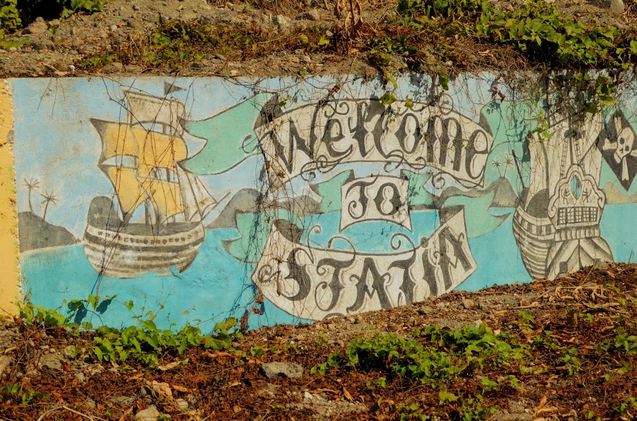
We were on a six hour trip south to Saba’s Dutch sister, the island of Sint Eustatius. Statia, as the locals call it, had its own peak for Scott to climb, and I was intrigued by the cruising guide’s description of several restaurants, and shops in restored warehouses along the water.
During the short journey, Scott put his lines in the water, and caught a good-sized mahi. Thankfully, this one had far less fight in him.

Like Saba’s, the Dutch island of St. Eustatius has no natural harbor, sandy beaches or abundance of fresh water. The rocky north end of the island is connected to a dormant volcano crater to the south, by a “saddle” of lower elevation.


In the 18th century, St. Eustatius was was one of the world’s busiest harbors. European powers were fighting each other, and England was trying to put down the American “rebels.” The Dutch island remained neutral during all of this, and became a tax-free haven. By the 1790s, over 3000 ships landed on ‘Golden Rock’ each year, and it wasn’t uncommon to see up to 300 ships at anchor.

At its peak, the capital of Oranjestad was most likely the richest port in the Caribbean. The island’s warehouses were stocked with every imaginable product from all over the world, and plantation owners and European manufacturers could quickly buy or sell anything on Statia, at anytime.
In 1776, an American merchant ship came into the harbor, and gave a salute. Statia’s governor fired off a return salute, becoming the first nation to salute an American vessel. In response, the British government brought the wrath of England down upon the tiny nation, for recognizing the newly independent United States (poor Statia).
The governor surrendered to Admiral Rodney, who confiscated the contents of all the ships and warehouses. Finding far less than expected, he soon noticed that the small population of merchants were having a lot of funerals. Admiral Rodney ordered one to be stopped, and found the coffin full of jewels and coins. A little digging in the graveyard revealed much more. He then had a giant auction, netting himself and his crew a fortune.
In 1796, the French took over Statia and implemented heavy taxes, which drove merchants away. The decline in trade continued, and today the sleepy island’s population is approximately 3,200. The government is the largest employer on Statia, and NuStar Energy’s busy oil terminal is the largest private employer on the island.
We approached Statia and traveled along the eastern coast, past NuStar Oil, and on toward Orangisted.


We dropped anchor, with The Quill (Scott’s hiking quest on this island) looming large off of our bow, and the island of St. Kitts visible in the distance.


Scott pulled the birds in from the paravanes, in order to attach our flopper-stoppers, which provide us stability at anchor. They’d collected quite a bit of seaweed in just six hours.


A rugged cliff splits the city’s capital (and the island’s only city/town) into what’s known as Upper Town and Lower Town. The narrow coastal strip which originally served as the island’s port makes up Lower Town, where a group of buildings just above sea level line the waterfront. A breakwater that protected the coastline here washed away long ago, and as a result, many of the original buildings are now submerged, due to hurricane damage over the years.


Lower Town now includes dive shops, a hotel, numerous ruins, a few restaurants and shops and the commercial harbor. Upper Town has a restored historic center, and is also the island’s main commercial and residential area.
We headed to shore, where the dinghy dock had seen better days. After clearing in, we walked the waterfront road, as I was eager to explore the shops and restaurants mentioned in the cruising guide. Sadly, the restaurant pickins were slim. Aside from a food truck near the dinghy dock, there were only three restaurants, one located in the only hotel in lower town. Even though only two of the total four were open, it wasn’t the end of the world.


We continued on, past several ruins of the former busy port town.


What was more disappointing was the lack of shops; we found one..also closed. Wait…the dive shop sold some trinkets, so I guess that counts? The closed shop also had a cool-looking bar attached….that was closed.


With lower town a shopping bust, we decided to check out upper town, and see if the “commercial” center offered more. The old slave road was the most direct route, but was closed, leaving two choices…walk the main road along the water, around a bend and up the hill into the far end of upper town, or hike a more direct path up the hill. Bleh. We found the path and began our climb, walking in full sun. It was a hot, steep go, and I grumbled the whole time….what a ridiculous way to get to town!


At the top, we caught our breath and enjoyed a bit of breeze. The hilltop provided great views of the harbor below, Sea Life at anchor and Saba towering on the horizon.


It was a short walk to the main road, passing one of Statia’s many goats along the way (more on these guys later).

On the way to the center of town, the streets were lined with old, and interesting buildings. We passed an intriguing shop….that was closed. Scott noticed Statia’s unique street signs, made from the lids of 55 gallon drums.


There were many restored buildings in the center of upper town, along brick and cobblestone streets. We didn’t see a scrap of trash anywhere, the area was insanely clean; maybe because there were no people. Upper town was nearly deserted. While we were there, two cars drove past us, and we saw only a handful of people. In the main circle, there were several cars, but no people in sight. It was eerily post-apocalyptic.


We hoped someone would come out of the woodwork and open Cool Corner, because how could you not visit a place called Cool Corner?!

During our stay on Statia we made several visits to town, each time traipsing up the hot, sweaty path, then catching breath and cooling off in the breezes at the top of the hill.


We made a visit to the museum in town, which had interesting artifacts and photos depicting the island’s history. Again, we had the museum, and surrounding streets, all to ourselves…bizarre!

We learned about the interesting history of Statia’s blue beads. Made in Amsterdam out of glass, the blue, pentagonal-shaped beads were the local currency of Statia in the 17th century. They were used to for trade in tobacco, rum, cotton and slaves, and were also given to slaves as “wages”.

After emancipation, legend says the newly-freed slaves gathered at the island’s cliffs, and threw the beads into the sea to celebrate their freedom.
Occasionally the beads can be found on the beach or somewhere in the mud on the roadside. Strong storms that stir up the sea floor will wash also them ashore, but they are insanely hard to find on the rocky beaches.
There were beads for sale in the museum, but we were told that a “real” blue bead will never be for sale for a few dollars, instead fetching prices of $250 – $300 USD. A Statian may give his blue bead away, but would never sell it, out of respect for the history it represents.

Island legend says that you don’t find a blue bead, it finds you, and if you’re found, you’ll return to Statia again and again. I toyed with buying one of the obviously not real beads for sale in the museum, priced at $20.00. We stopped back by to get one, and…you guessed it, they were closed (even though the posted hours showed they should’ve been open). A bead was definitely not looking to find me.
We found a gift shop on one of the back streets, but all I came away with was a beer huggie.


It came in handy minutes later, when we stopped at Cool Bar, which was open!!!! The beer was more than cool, it was awesomely cold, and we had terrific Chinese food. Yep, a Chinese family, running a dive bar with Chinese food, in the Caribbean, on the island of Statia – go figure.

As always, we trudged back down the steep, hot path to lower town. A stupid way to get back and forth….at least the view along the way was good.


Scott’s mission in Statia was to hike The Quill, which dominates Statia’s landscape. The dormant volcano’s massive crater gets its name from the Dutch word for pit or hole, and its highest point rises almost 2,000 ft above sea level.


Approximately 1,600 years ago, an eruption in 400 AD joined The Quill with what is now the rest of Sint Eustatius, forming a perfectly symmetrical cone.

The Quill is now part of a national park on the island. Hikers can climb to the top, and down into the crater. Just to get to the start of path requires a 45 minute, hot-sun walk, so Scott left the boat early in the morning to begin his trek to the top of the crater. Even at the beginning of his hike, Scott was already high enough to see back down toward the anchorage.

He set out on the usual, island-like trail, passing signs along the way that marked his progress.


After almost three hours, Scott reached the rim of the crater.


The area around the crater is made up of a miniature, but lush rainforest. Everthing was steriod-sized, Scott walked past huge elephant ears, rocks, banana plants orchids, and many twisted, strangler fig trees.


The twisting behemoths are in the same family as banyan trees, and begin their life when seeds, often dropped by birds, germinate in the crevices of other trees. These seedlings grow their roots downward and envelop the host tree, while also growing upward to reach into the sunlight above.

The original “support” tree can sometimes die, leaving the strangler fig to become a “columnar tree,” with a hollow central core. It is also believed that the strangler fig can help the support tree survive storms, which isn’t surprising, after seeing the size of some of the massive roots.


Scott climbed down to the dense floor of the dome, finding signs of those who came before him. He hiked around the dome floor, looking back up at the crater edge above him.


After climbing back up to the top, Scott took time to survey the panoramic surroundings, looking across to the other side of the dome. Beyond it, Saba lay on the horizon, and tiny Sea Life was visible in the anchorage below.


Behind him, St. Kitts loomed large on the horizon.


Scott arrived back at the boat much sooner than expected, tired and hot, but happy with himself for conquering The Quill. Howard was usually interested in Scott’s shoes. We’re used to him sniffing all over our shoes when we come back from shore, but this was above and beyond. He sniffed them, licked them, chewed them, tried to get his head in them, and generally rolled all over them. You’d have thought Scott walked through fields of catnip all day..it was crazy!


When he’d had his fill of the shoes, Scott backpack got the same treatment.


When he’d finally had his fill of Quill smells, Howard relaxed on his new favorite bed.

After five days, the weather was looking good for us to move on. On our last night, we had dinner at one of the restaurants in lower town, then prepared for travel the next day.


It felt like we’d has Statia all to ourselves, as we’d seen so few people during our visit. Time to leave this eerily quiet island, and head for the buzz of St. Barths! Here are more photos of our time on Statia.
“Shells Sink, Dreams Float. Life’s Good On Our Boat!”
The pics are outstanding. The place looked beautiful. ( The Naked Pig. Lol)
Piper waves Hi to Howard.
I SOO wanted to go INTO the Naked Pig, but sadly, it was always closed. Looking forward to seeing the three of you soon!