After saying goodbye to our friends who’d headed off for southern destinations a day before us, we slipped the lines from our mooring ball, and cruised away from the Ile des Saintes to begin the short, six hour run to Dominica.
We’d hoped to visit the island last year, on our way south for hurricane season, but as time got short, Scott grew anxious to get settled in Grenada before the peak of the season. We passed by Dominica, planning to visit on our way north in 2018…..who knew Hurricane Maria would make a direct hit, and devastate the island.
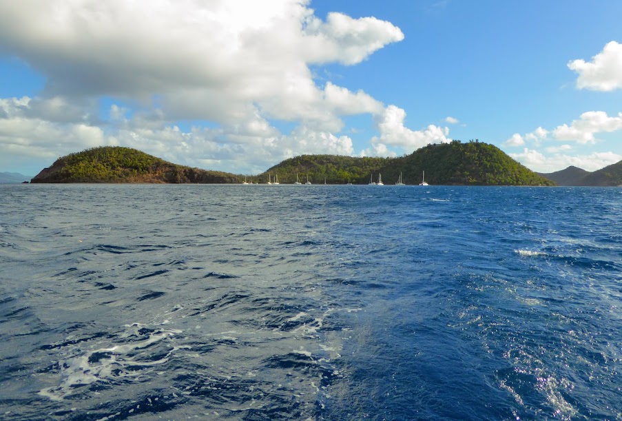
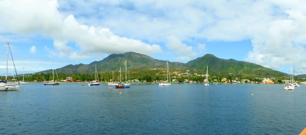
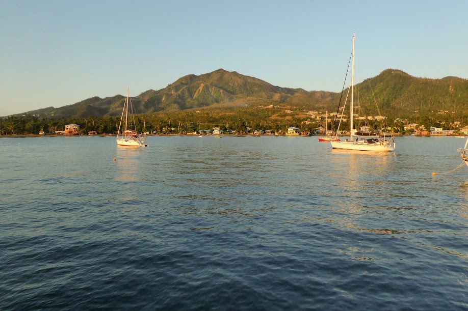
Dominica is located midway along the Eastern Caribbean islands, just a few miles from Martinique to the south and Guadeloupe to the north. We were heading for Portsmouth, on the island’s northwest side.
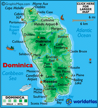
The name Dominica is derived from the Latin word for “Sunday,” as Columbus is said to have passed the island on a Sunday in November of 1493. The island is sparsely populated compared to its size, with 70,000 people inhabiting the island’s 289 square miles, and a significant portion of that population lives in and around the capital city of Roseau.
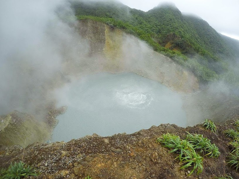
Dominica is the youngest island in the Lesser Antillies, still being “formed” by extensive, geothermal-volcanic activity…even underwater. It is also home to the world’s second largest hot spring, Boiling Lake (we didn’t visit the lake, but I found some great photos online, from other bloggers, and on Wikipedia).
Known as “The Nature Island,”tropical rain forests cover two thirds of Dominica, and it is home to many rare species of plants, animals and birds, protected by an extensive natural park system (The Morne Trois Pitons National Park was the first UNESCO World Heritage Site in the eastern Caribbean). Rivers (365 of them), lakes, streams and waterfalls cover the island, fed by a high annual rainfall.
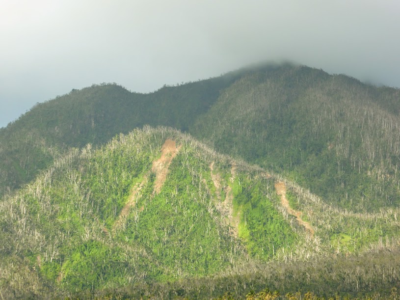
It is said that if Christopher Columbus came back to the Caribbean today, Dominica is the only island he would recognize. Unlike most all other Eastern Caribbean islands, Dominica has remained both commercially and residentially undeveloped, with only a few small hotels and inns. When trying to describe the mountains of Dominica to King Ferdinand and Queen Isabella of Spain, Columbus resorted to crumpling up a sheet of paper, in order to illustrate the dramatic form of the land, with it’s valleys, gorges and peaks. Sadly, the island’s appearance is much different now, after Hurricane Maria.
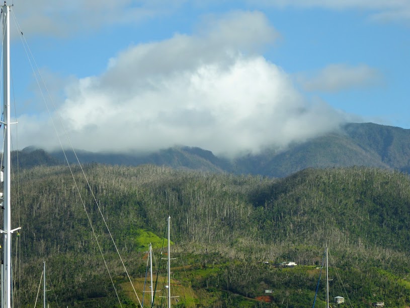
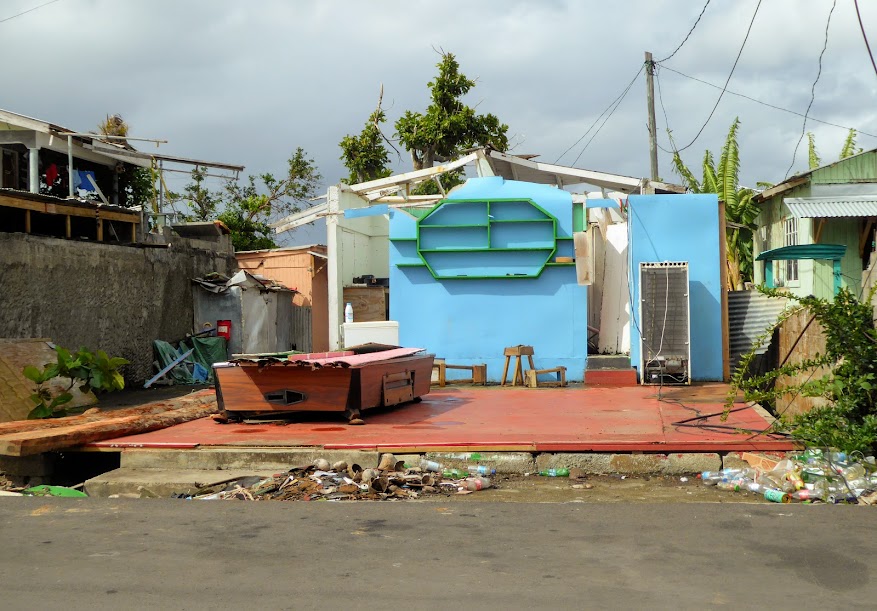
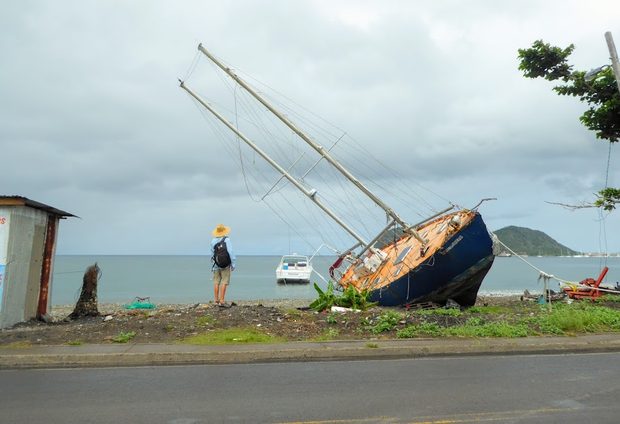
On the evening of Sept. 18, 2017, Hurricane Maria hit Dominica at full, category-five force, with 160 mph winds. The brutal storm damaged or destroyed roofs of 90 percent of buildings, toppled power lines, and sent some of the thickest, strongest and oldest trees in the forests smashing to the ground. Maria’s rains triggered landslides that turned the island’s 365 rivers into raging coils that washed away bridges and crops, and slashed deep cuts along what had been well-laid roads. The storm is now the island’s worst natural disaster on record.
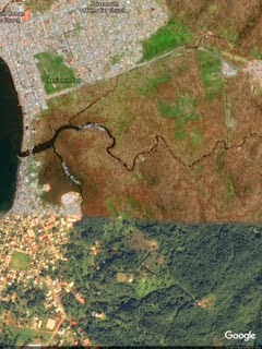
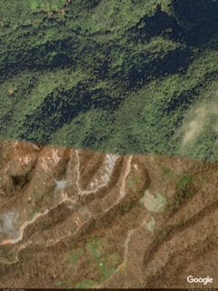
Hurricane Maria was one of the fastest intensifying hurricanes ever recorded, blowing up from a tropical storm into a major Category 5 hurricane in barely more than a day. Dominica was this fierce storm’s first victim, and it’s clear from these before and after photos from Google Earth, that she showed no mercy, changing it’s hills and valleys from lush green to brown. When Maria hit the island, poor Dominica was still recovering from Tropical Storm Erika, which killed 30 people, destroyed more than 370 homes and caused extensive flooding in August of 2015.
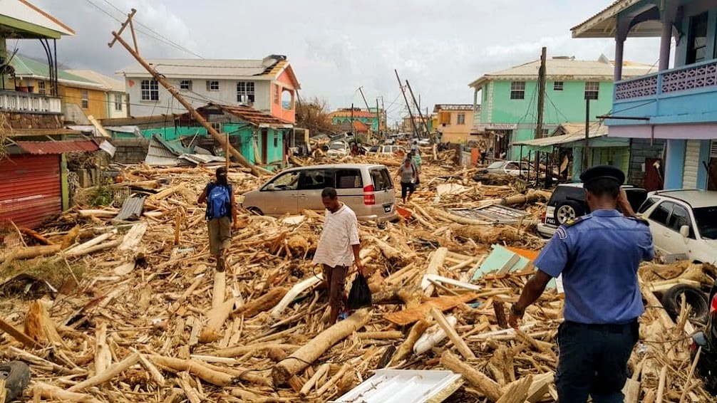
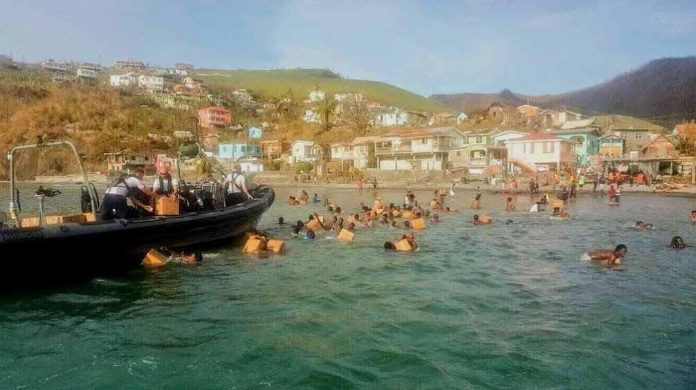
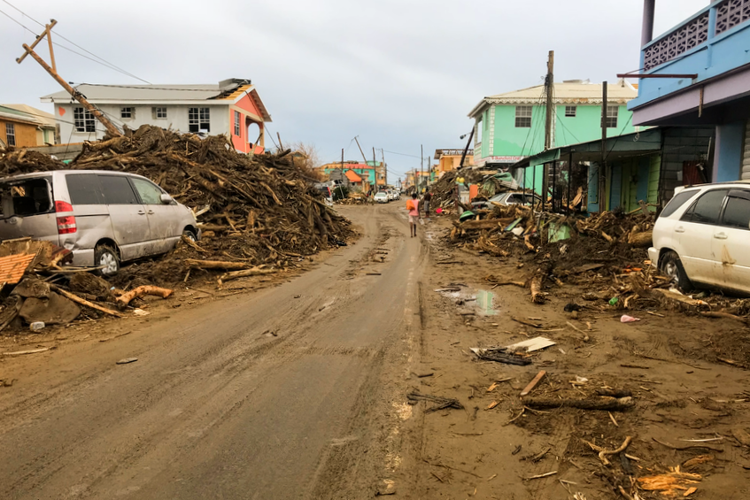
I found some online images of Portsmouth, just days after Maria, and of relief supplied arriving from neighboring islands.

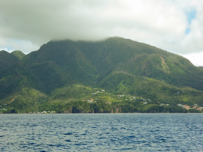
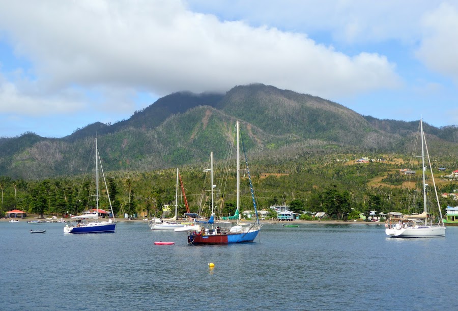
As we approached, Dominica appeared much greener than expected.

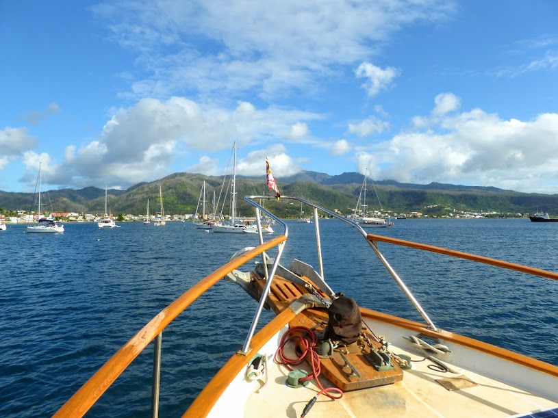
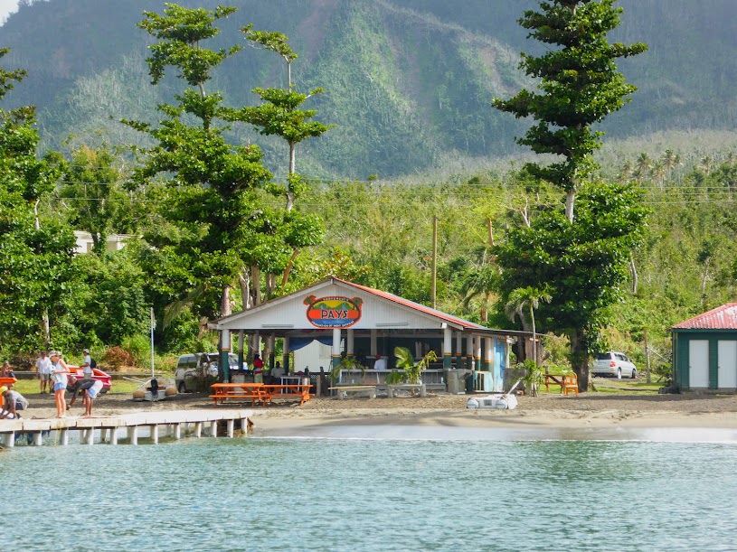
We made our way into the anchorage at Portsmouth, and hailed PAYS on the vhf. In the past, Dominica was far less safe for cruisers, with many reports of theft from boats at anchor. Realizing that this was affecting their livelihood, local tour guides formed the Portsmouth Association of Yacht Services, or PAYS, who run regular patrols in the anchorage at night, and since the association has been active, there have been no reports of trouble.
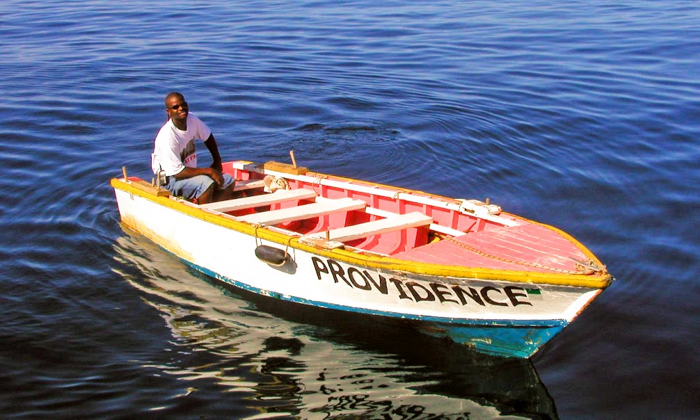
The men of PAYS have “interesting” names, such as Lawrence of Arabia Providence, Cobra, Spaghetti and Sea Bird, and usually have several boats working under their name (photos from other blogs) They come out to greet boaters entering the anchorage, and help them secure to mooring balls. We could have dropped anchor, but chose to take a ball, as the fee goes towards supporting PAYS. The guys also help set up island tours, dispose of trash and host a weekly Sunday barbecue that has become well known in the Eastern Caribbean.

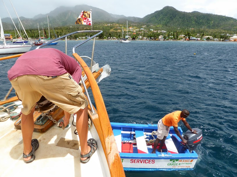
Daniel, who is affiliated with Eddison, replied to our call and came out to the boat as we entered the bay. He told us that Eddison would meet us in the anchorage, and then headed out to fish. Eddison was ready and waiting, and waved us over to an open ball, helping us tie on.
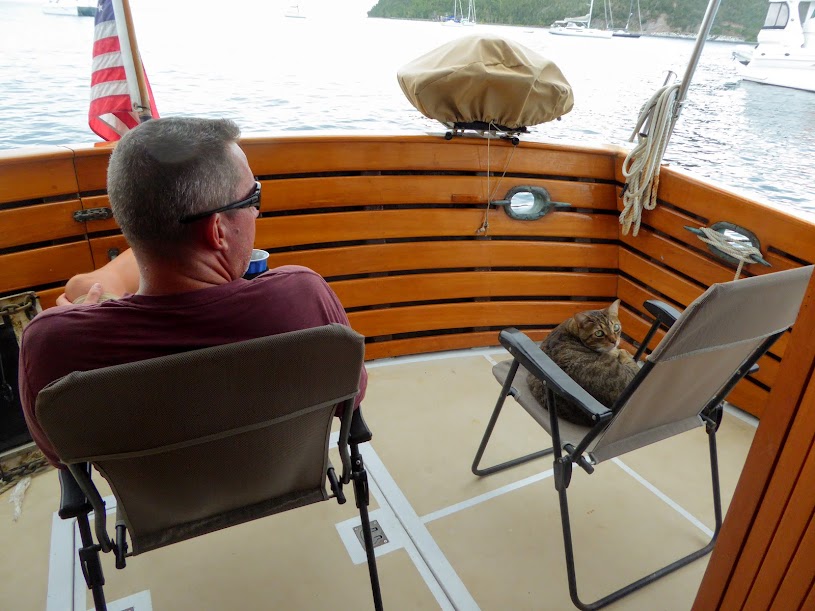
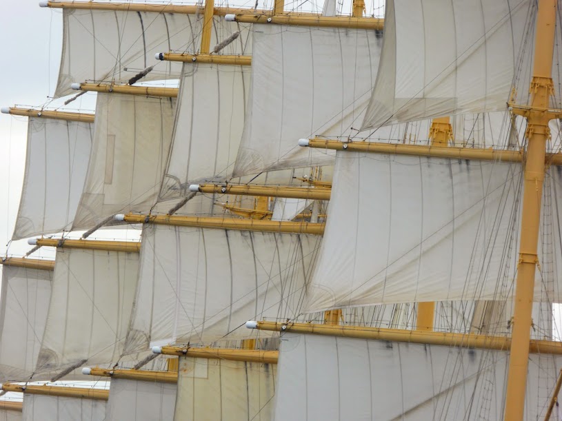
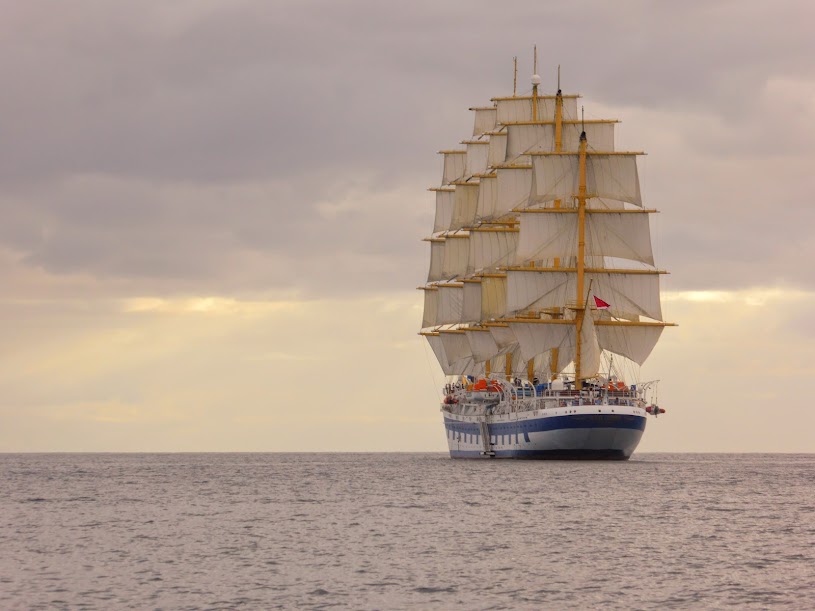
We settled in to enjoy the evening. Scott and Howard (aka, Bartles and James) made themselves comfortable in the cockpit, and we watched one of the sailing cruise ships raise sails to head south, which was quite a sight.


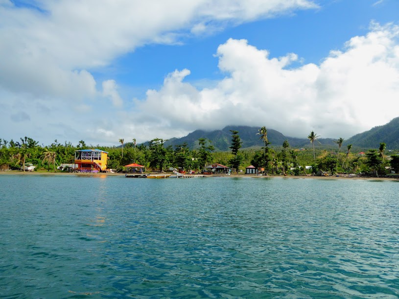
We made our way to the PAYS dock, that had recently been rebuilt, along with a new pavilion that’s used for Sunday barbecues.
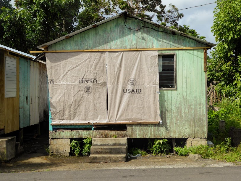
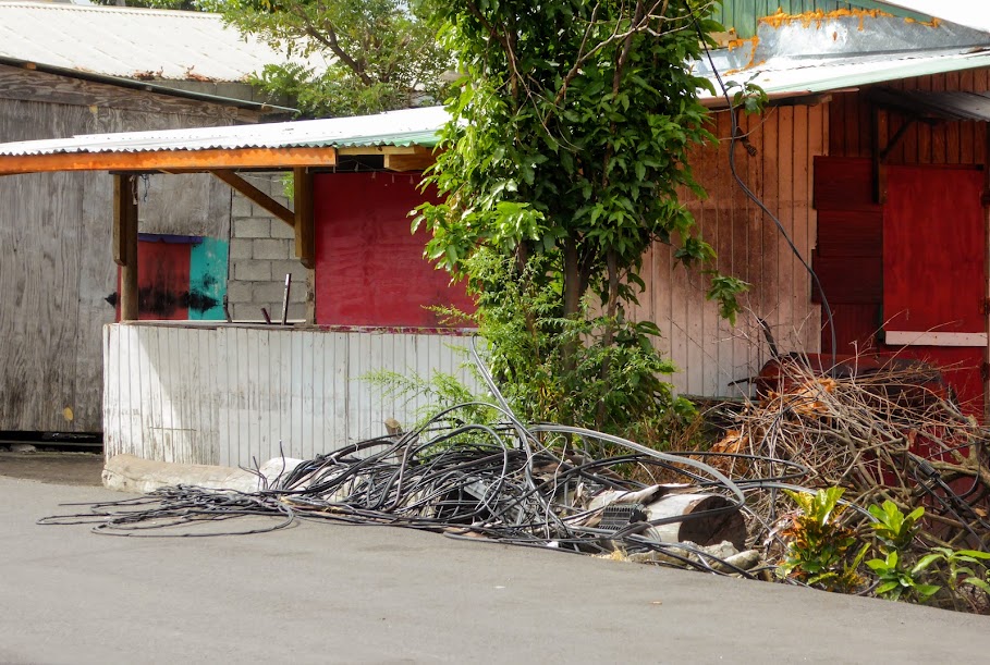
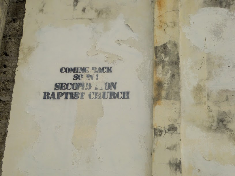
From there, it was a short walk to town. The road was lined with homes and buildings covered in tarps, and others left with a foundation and some pieces of wall.
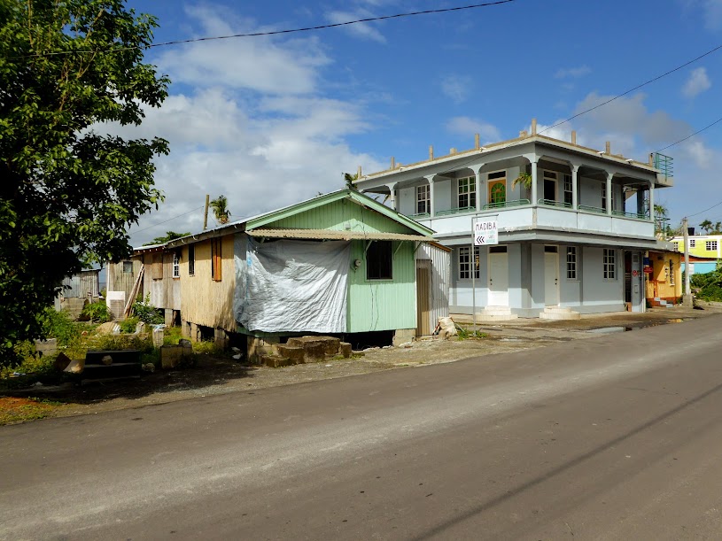
Here is view of the main road in town, when we saw it, and just after Maria (approximately the same location).
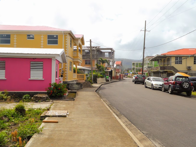


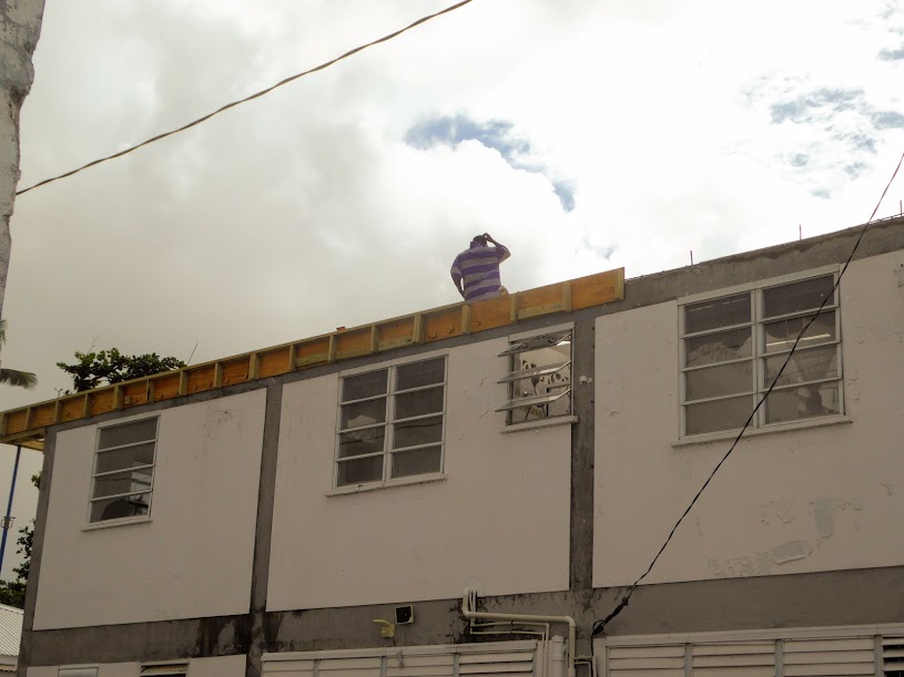
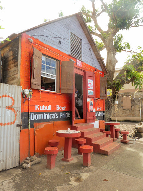
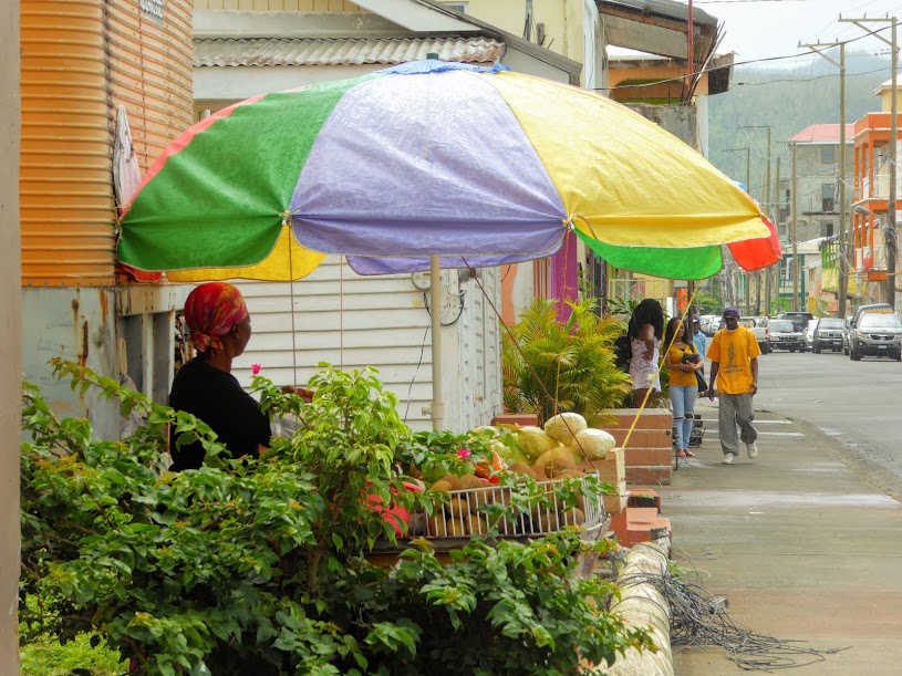
For the most part, it was business as usual in town, stores were open, including the local bars, and several people were set up along the sidewalks, selling fruits and vegetables.
“Shells Sink, Dreams Float. Life’s Good On Our Boat!”